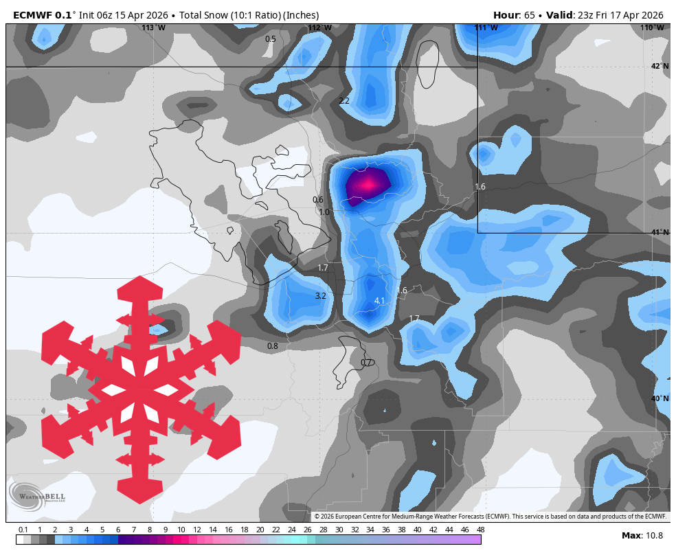
#snow-levels-and-wind-conditions
#snow-levels-and-wind-conditions
[ follow ]
#snowfall #winter-storm #weather #skiing #northern-rockies #snow-forecast #ski-resorts #ski-conditions


fromSnowBrains
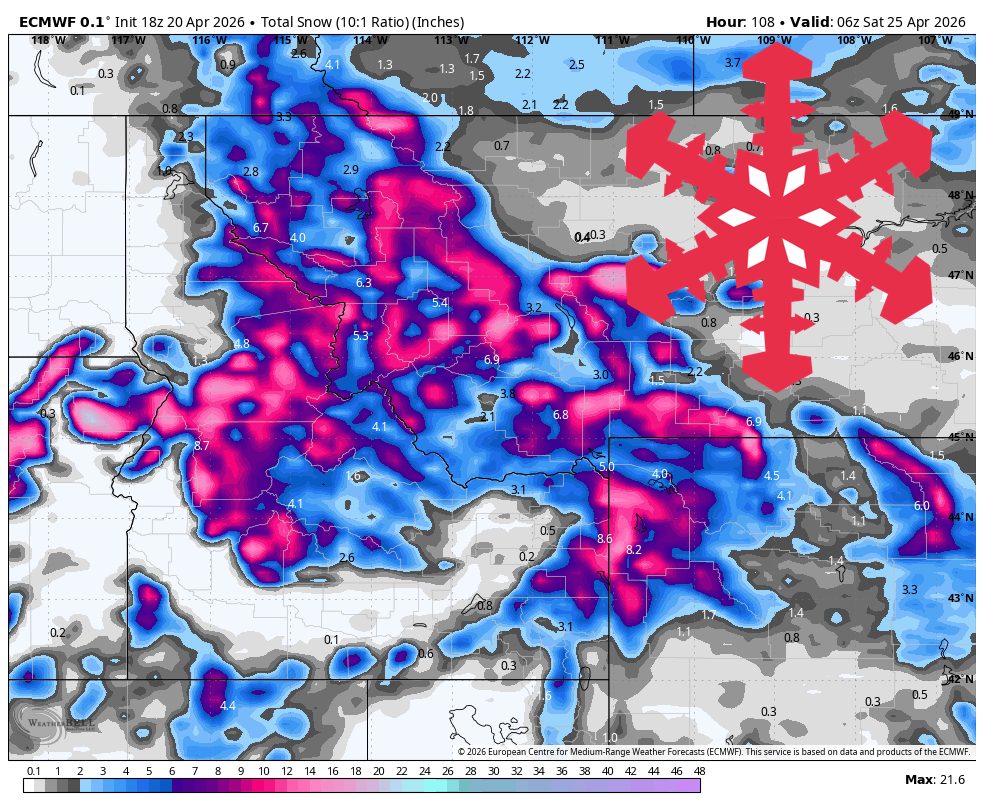
17 hours agoSnowBrains Forecast: Up to 10 Inches on the Highest PNW Terrain Midweek - SnowBrains
Timberline is the clear winner for open terrain with around 7-9 inches, while Mt. Bachelor picks up 4-5 inches but remains closed. Most Washington resorts look too warm or too dry for meaningful new snow.
Snowboarding
fromSnowBrains
1 day agoSnowBrains Forecast: Light High-Elevation Snow for South America Through Tuesday - SnowBrains
The ongoing Sunday night into Monday storm across the central Andes keeps producing mainly upper-mountain snow through Monday before tapering out by Tuesday morning, April 21. A realistic near-term outcome is about 16-20 cm at Las Leñas, 9-11 cm at Valle Nevado, and lighter 5-8 cm amounts around El Colorado, La Parva, and Portillo.
Snowboarding


fromSnowBrains
5 days agoSnowBrains Forecast: Light BC Snow, 10-20 Centimeters in Alberta Through Friday for BC/Alberta - SnowBrains
The ongoing storm is expected to add 13-16 cm at Banff Sunshine and around 4-5 cm at Lake Louise by Friday morning, with the deepest moisture focused on Alberta.
Snowboarding
fromSnowBrains
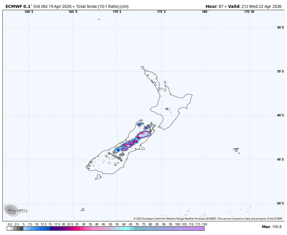
5 days agoSnowBrains Forecast: 1 Meter Plus for New Zealand's South Island Through Thursday - SnowBrains
From Sunday afternoon through Tuesday night, the guidance lines up on a prolonged South Island storm cycle. Timing confidence is good, with snow pushing in Sunday afternoon and ramping hard Sunday night.
Snowboarding

fromSilicon Canals
2 months agoThe one thing meteorologists wish people would stop doing before a winter storm hits - Silicon Canals
When I spoke with emergency management officials last year, they all mentioned the same frustrating scenario. People ignore storm warnings until the precipitation starts falling, then suddenly everyone rushes out at once. The roads become congested with anxious drivers, accidents spike, and stores run out of essentials just when people need them most. But here's what really gets meteorologists worked up about this pattern. Modern weather forecasting has become incredibly accurate, especially for major winter storms.
Public health


fromwww.theguardian.com
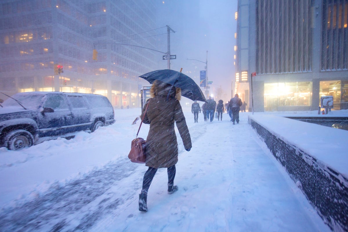
2 months agoBomb cyclone brings freezing temperatures and snow to millions in US
A bomb cyclone produced freezing temperatures across a large portion of the US from the Gulf coast to New England, bringing heavy snow to North Carolina where two were killed in storm-related conditions, and setting records in Florida, where officials warned of ice and falling iguanas. About 150 million people were under cold weather advisories and extreme cold warnings in the eastern portion of the US,
Environment
fromwww.theguardian.com
1 month agoLess snow, or more risk? What you need to know about avalanches and climate change
Avalanches kill about 100 people in Europe each year, with vast masses of ice, snow and rock regularly crashing down on hikers and skiers who have been caught unawares. The structure of the snow, angle of the slope and variation of the weather can dictate whether a gentle disturbance like a gust of wind or the glide of a snowboard can trigger a deadly shift in the mountain.
Environment
Environment
fromwww.mercurynews.com
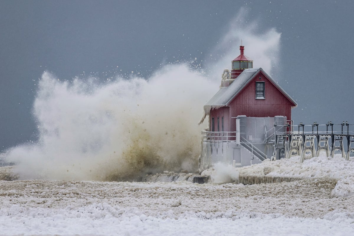
2 months agoMeteorologists blame a stretched polar vortex, moisture, lack of sea ice for dangerous winter blast
Warm Arctic waters and cold land are elongating the polar vortex, bringing subzero temperatures, heavy snow, and crippling ice across much of the United States.
Snowboarding
fromSnowBrains
1 month agoSnowBrains Forecast: Warm, Windy, Mostly Dry Northern Rockies Through Monday - SnowBrains
A strong spring ridge brings warm, dry conditions through Friday with fast snow softening and high snow levels, followed by a weaker cold front bringing cooler temperatures and minor snow refresh over the weekend.
Snowboarding
fromSnowBrains
1 month agoSnowBrains Forecast: Springlike, Mostly Dry Pattern for Colorado Through Sunday - SnowBrains
Colorado ski resorts face warm, dry spring conditions through Sunday with afternoon temperatures in the upper 40s to 60s, minimal snowfall, and periodic ridge winds of 25-40 mph.

Snowboarding
fromSnowBrains
1 month agoSnowBrains Forecast: Windy Weekend Snow Then Springlike Warmth in the Northern Rockies - SnowBrains
A cold front Saturday and lighter snow Sunday night into Monday will deliver 5-7 inches at Big Sky and 4-5 inches at Whitefish Mountain, Jackson Hole, and Bridger Bowl, followed by spring conditions with warming and firming mornings.
Snowboarding
fromSnowBrains
1 month agoMountain Weather Update: Is Winter Over? Chris Tomer Answers the Question on Everyone's Lips - SnowBrains
A high-pressure dome will create a dry spell across southern ski regions while northern Rockies and Pacific Northwest receive significant snow through early April.
fromUnofficial Networks
2 months agoThe Next Week Is Looking Sad For North American Snowfall
Many of us are riding the high of the recent major snowstorm wondering when the next big powder day will swing through. Unfortunately for most of North America, it looks like the snowy weather won't be returning anytime soon, or at least not for the next week. Meteorologist Chris Tomer 's Mountain Weather Update paints a rather sad picture for snowfall totals in North America between January 29th and February 5th.
Snowboarding

fromSnowBrains
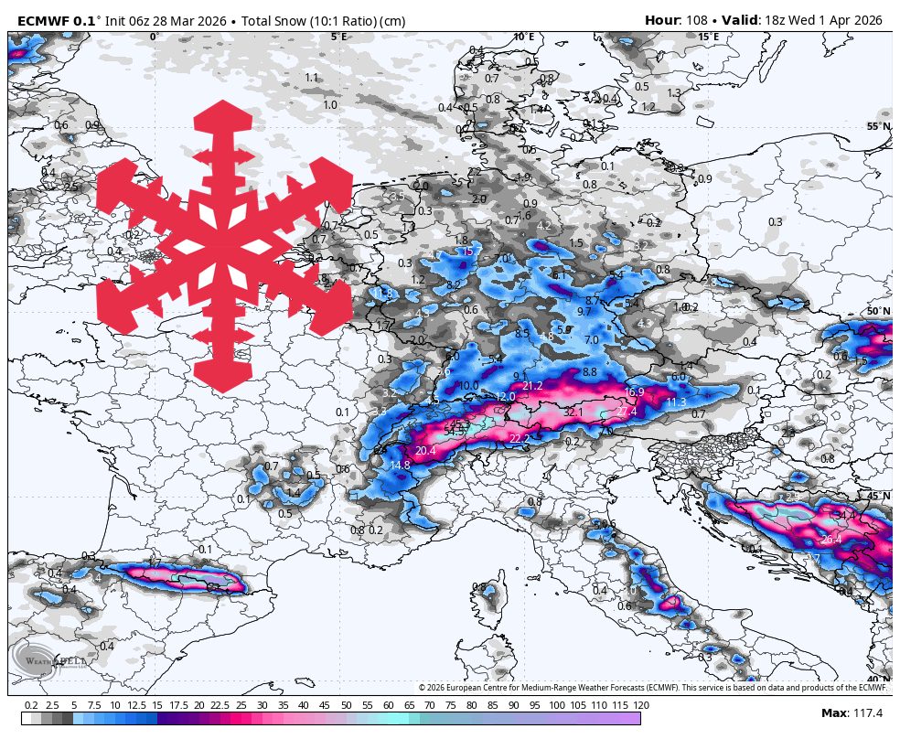
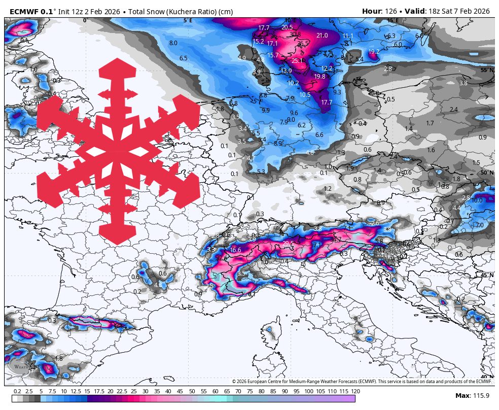
2 months agoSnowBrains Forecast: 1-2 Meters for Europe This Week - SnowBrains
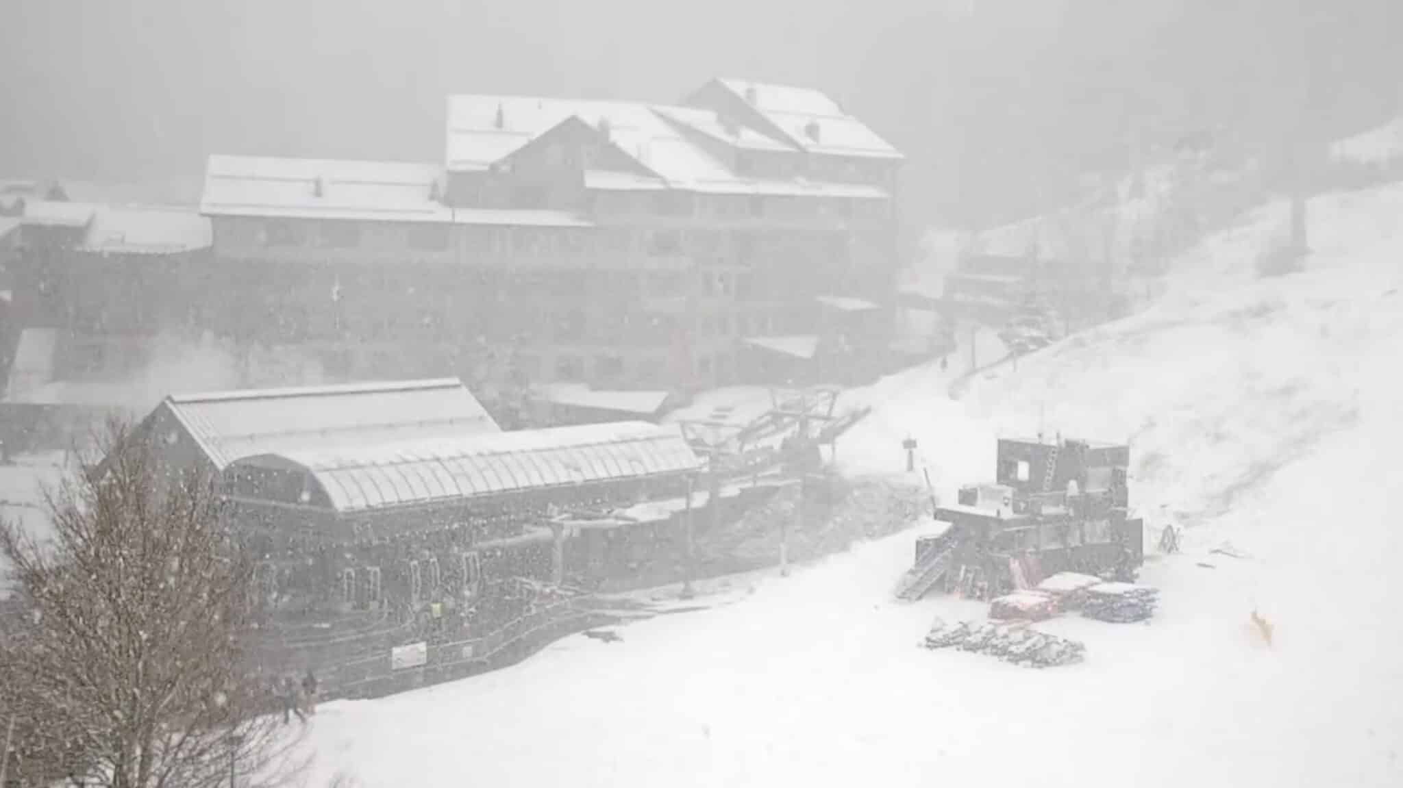
WeatherA multi-day storm cycle targets the Alps this week, then reloads with colder air next weekend while snow chances continue into midweek. The western Alps look like the main winners overall, with frequent snowfall pulses and the deepest totals at higher elevations. Snow levels run high enough at times midweek to keep lower villages on the edge of wet snow or rain, then they drop sharply heading into the weekend.
Snowboarding
Snowboarding
fromSnowBrains
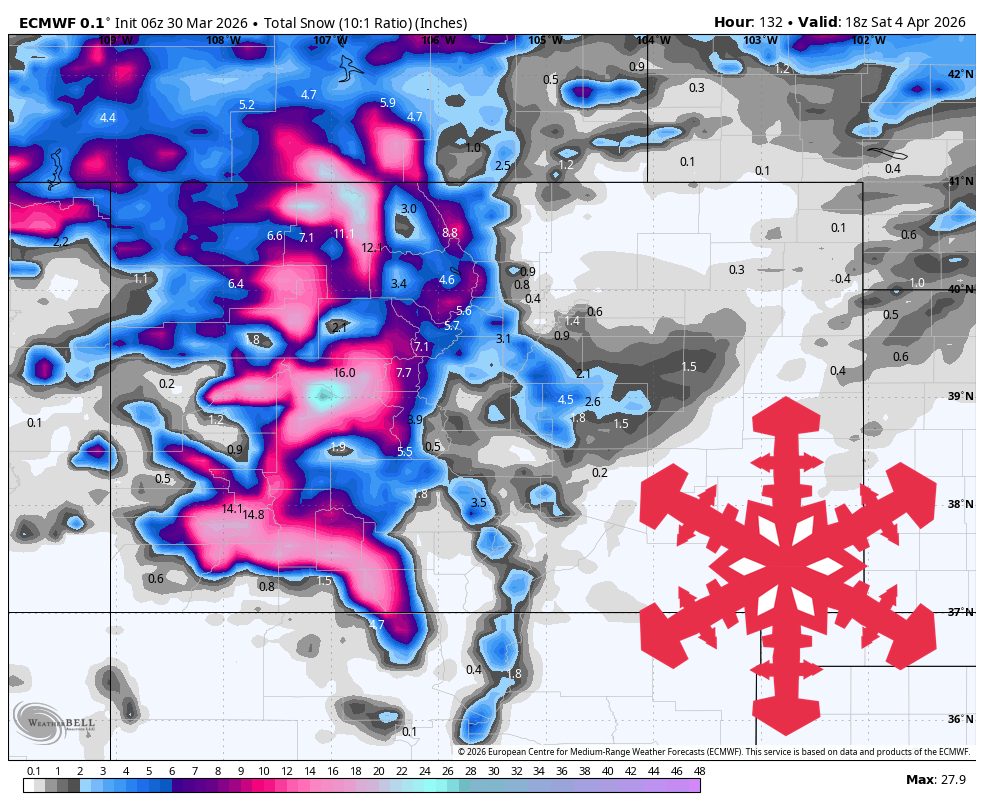
1 month agoSnowBrains Forecast: Wet Early Snow Then Variable Conditions for Colorado - SnowBrains
Mountain snowfall peaks through Thursday with heavy wet snow and strong winds, followed by uncertain lighter accumulations and a return to warmer, quieter conditions by the weekend.
fromSnowBrains
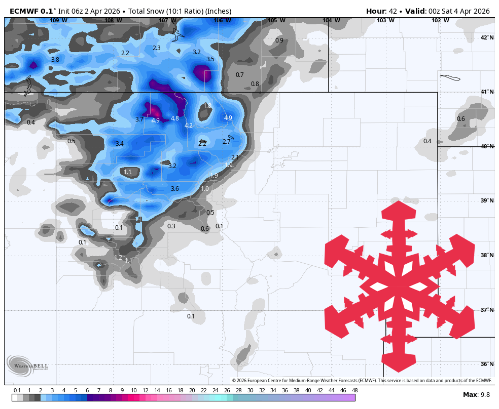
2 months agoSnowBrains Forecast: Snow Finally Returns to Colorado With 1 Foot This Week - SnowBrains
The midweek stretch looks like the most reliable window for fresh turns, with the steadiest snow lining up Wednesday night into Thursday and lighter add-ons into Friday. Snow levels run a little high early, then step down late week, so snow quality should improve as the storm cycle matures. Some areas could see the next wave begin as early as Sun night (02/15), but confidence drops quickly with lead time and placement.
Snowboarding
fromSnowBrains
2 months agoThe West Waits for Snow as the East Braces for a Potentially Historic Storm - SnowBrains
WeatherAs forecasters anxiously watch models for better agreement, one thing is clear: a major winter storm-named Winter Storm Fern by The Weather Channel-is forecast to impact a vast portion of the United States this weekend, bringing a dangerous combination of heavy snow, ice, and extreme cold to much of the country. Winter Storm Fern is expected to impact more than 230 million people across roughly two-thirds of the U.S., stretching across approximately 33 states.
Snowboarding
Snowboarding
fromSnowBrains
1 month agoSnowBrains Forecast: Up to 1 Foot for Colorado Through Saturday - SnowBrains
Colorado mountains receive two ski-relevant snowfall events through Saturday: light-to-moderate snow today with 1-6 inches, then a stronger, colder round Friday into Saturday with 6-11 inches in north-central terrain and 1-5 inches in southern areas.
Snowboarding
fromSnowBrains
1 month agoSnowBrains Forecast: Mostly Dry European Alps, Around 10 cm in a Monday-Tuesday Refresh - SnowBrains
European Alps experience mostly dry weather through Sunday, followed by modest Monday-Tuesday snow near higher Swiss-Italian terrain, with next weekend potentially bringing more organized storm activity.
fromSnowBrains
1 month agoSnowBrains Forecast: Up to 10 Inches for Colorado Through Wednesday - SnowBrains
From late Saturday night through Sunday, guidance is converging on timing and warmer snow levels but diverging on intensity and ridge-top wind magnitude, with the most consistent signal for light snowfall in the northern and central ranges and limited coverage farther south. Most mountains should stay in the low single digits for accumulation during this first push, with favored terrain near the Continental Divide able to approach around 4 inches by Sunday evening.
Snowboarding
[ Load more ]