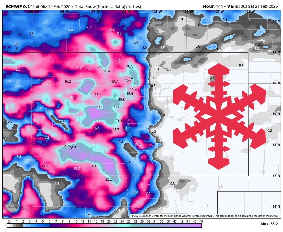
"WeatherA long, windy storm cycle brings Colorado's best powder setup of the next 10 days, with snow building from Monday night through Saturday morning. The steadiest stretch runs Tuesday through Thursday, then a smaller follow-up wave arrives Friday into early Saturday. Snow levels stay low enough for all snow at every resort once precipitation gets going, and snow quality improves as colder air settles in midweek, with frequent SLRs in the mid-teens and higher."
"Sunday and Monday stay mild and mostly dry, then snow returns to the high country late Monday night as winds ramp up fast. The models are converging on the Monday night into Tuesday transition, with light snow starting first in the southern mountains and spreading into the central and northern ranges by Tuesday morning. Snow levels during the snowy periods generally sit in the 2,000 to 6,000 feet range,"
A long, windy storm cycle will deliver significant Colorado snowfall from Monday night through Saturday morning, with the steadiest precipitation Tuesday through Thursday and a smaller follow-up Friday into Saturday. Snow levels will remain between roughly 2,000 and 6,000 feet, keeping every resort on the snow side. Early accumulations may exhibit denser 10–14:1 ratios before colder midweek air increases powder quality and mid-teens SLRs become frequent. Winds will be the primary on-mountain impact, especially Tuesday and Wednesday when exposed ridgelines could see 40–60 mph gusts and blowing snow. After Saturday the pattern trends quieter and confidence in later chances falls.
Read at SnowBrains
Unable to calculate read time
Collection
[
|
...
]