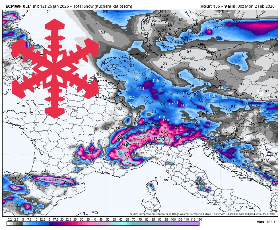
"A midweek storm lays down a solid base, then the Tarentaise (Val Thorens, Tignes, Val d'Isère) reloads again into the weekend, pushing totals to 28-46 cm (11″-18″) in the best spots, while Chamonix can stack 25-43 cm (10″-17″). Snow levels generally hover around 670-1,070 m (2,200-3,500 feet) and frequently dip lower, so precipitation falls as snow at almost all ski elevations."
"Thursday night (01/29) through Sunday (02/01) keeps the Tarentaise in the bullseye and upgrades snow quality in the highest French zones. Val Thorens adds another 15-25 cm (6″-10″) in this stretch, with Tignes and Val d'Isère each tacking on about 8-15 cm (3″-6″), building a steady, layered refresh rather than one single dump. Snow levels dip to about 580-610 m (1,900-2,000 feet) at times and generally sit below 975 m (3,200 feet), keeping precipitation solidly snow across the mountain."
A multi-part pattern will keep the Alps active through Sunday, concentrating the deepest snowfall on the highest French terrain and the Mont Blanc zone. A midweek storm lays a foundational base and the Tarentaise (Val Thorens, Tignes, Val d'Isère) reloads into the weekend, with peak totals of roughly 28–46 cm in top locations and Chamonix near 25–43 cm. Snow levels commonly range from about 580 to 1,220 m and frequently dip lower, producing mostly all-snow precipitation at ski elevations. Snow-liquid ratios typically fall between about 12:1 and 18:1, yielding generally favorable, relatively fluffy snow. Winds remain mostly modest aside from occasional high-alpine gusts.
Read at SnowBrains
Unable to calculate read time
Collection
[
|
...
]