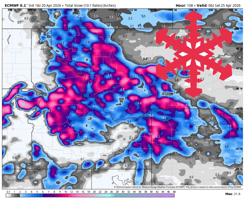
"From Wednesday night through Friday, the guidance stays well aligned on a colder backside phase, although the spread opens a bit on where the steadiest lingering bands set up. Snow levels continue lowering into roughly 3,000-5,000 feet by Thursday and Friday, while temperatures settle into the 20s and low 30s at ski elevations."
"Expect southwest to west gusts of 25-40 mph at many ski elevations, with stronger exposed ridges, and expect snow levels to start high enough for mixed lower-elevation precipitation in some zones before colder air catches up."
A midweek weather shift will transition the Northern Rockies from warm spring conditions to colder, windier storms. From Wednesday morning to Friday night, snow levels will drop from 6,000-7,000 feet to 3,000-5,000 feet, with the Tetons, southwest Montana, and west-central Idaho receiving 1-2 feet of snow. The weekend will be cooler with lighter mountain showers. Tuesday will be the last warm day, with temperatures in the 40s to low 50s before the storm arrives, bringing gusty winds and mixed precipitation.
Read at SnowBrains
Unable to calculate read time
Collection
[
|
...
]