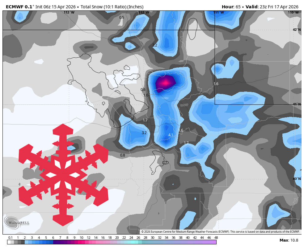
"The best ski window at the open Wasatch resorts looks to be Thursday night into Friday morning, when snow quality improves quickly behind the front as snow levels crash well below resort bases."
"Models are converging on Thursday into Friday as the main ski-weather period, with snow building first in northern Utah, peaking Thursday afternoon and evening, then tapering to lingering Friday snow showers."
"Snow levels start around 7,500-8,000 feet, then fall below 5,000 feet by late Thursday afternoon and toward valley floors overnight, so all resort elevations turn solidly snowy."
A brief lull in weather precedes a cold front arriving Thursday and Friday, providing useful snowfall for Wasatch resorts. The best skiing conditions will occur Thursday night into Friday morning as snow levels drop below resort bases. Wednesday features light showers and breezy conditions, while southern Utah remains mostly dry until Thursday night. Snow levels will decrease significantly, enhancing snow quality. Confidence in snowfall timing is high, with models indicating improved conditions for skiing at various resorts during this period.
Read at SnowBrains
Unable to calculate read time
Collection
[
|
...
]