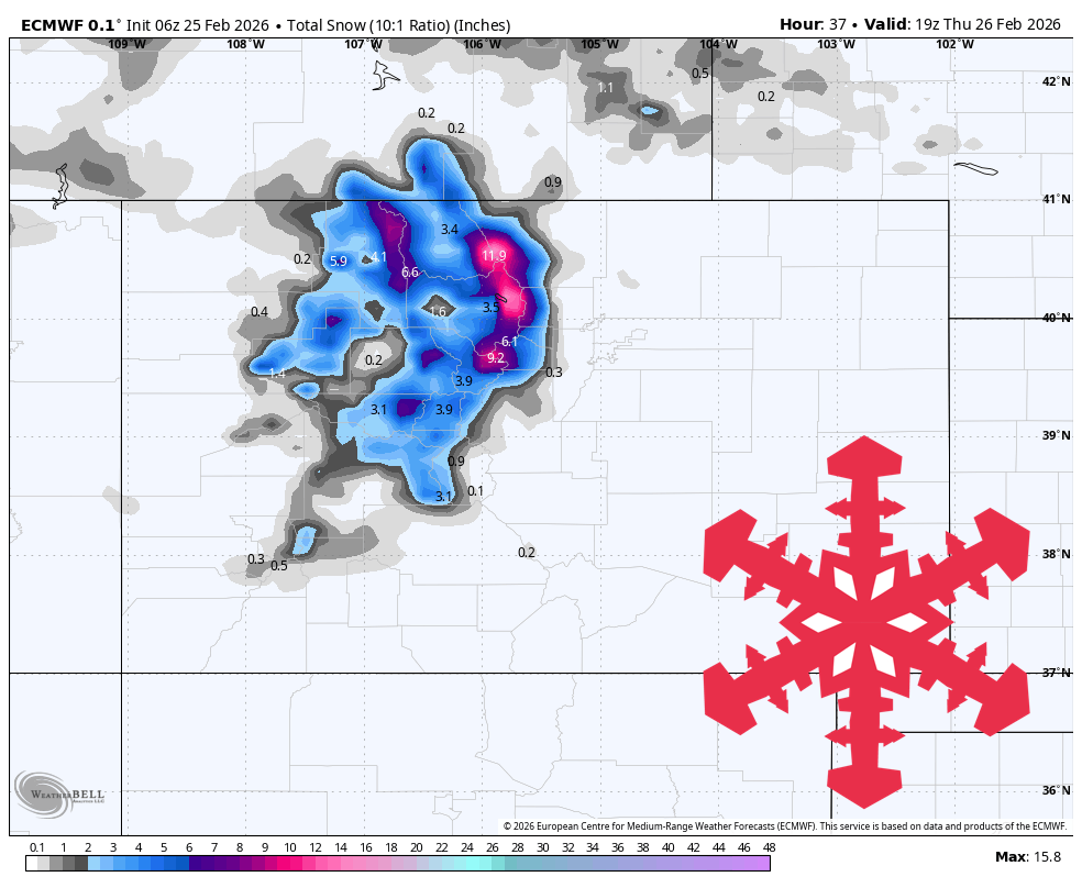
"Guidance aligns on ongoing snowfall from this morning through Thursday, centered in the Park, Rockies and higher Front Range terrain. Wind speeds are expected to be brisk, with gusts commonly around 45 to 50 mph at exposed elevations and sustained flow near 20 mph, producing rougher conditions on upper bowls and ridgelines."
"SLR values are highly variable but often hover around 7 to 14:1 with frequent dips into the lower values during the heaviest portions, so new snow quality is likely mixed, with some heavy, dense bands and intermittent workable dry-to-firm transitions."
"After Wednesday night into Friday, model guidance gradually loses agreement and snowfall signals become patchier. Most guidance keeps the immediate active phase tapering through Thursday, with a brief lull for much of Friday, while the cold front and wind shifts reduce moisture."
Heavy mountain snowfall dominates through Thursday across central and northern Colorado, particularly in the Park, Rockies, and higher Front Range terrain. Wind gusts reach 45-50 mph at exposed elevations with sustained flows near 20 mph, creating rough conditions on upper terrain. Snow levels range from 6,500 to 11,000 feet, with mixed outcomes at lower elevations while higher terrain remains snowy. Snow-to-liquid ratios vary between 7 to 14:1, producing mixed quality with dense bands and dry-to-firm transitions. After Wednesday night, model agreement deteriorates significantly. Most guidance shows the active phase tapering through Thursday with a Friday lull, though some solutions indicate light weekend snow bands with substantial timing and total uncertainties. Conditions gradually transition toward warmer, drier weather with settled surface cycles.
Read at SnowBrains
Unable to calculate read time
Collection
[
|
...
]