Snowboarding
fromSnowBrains
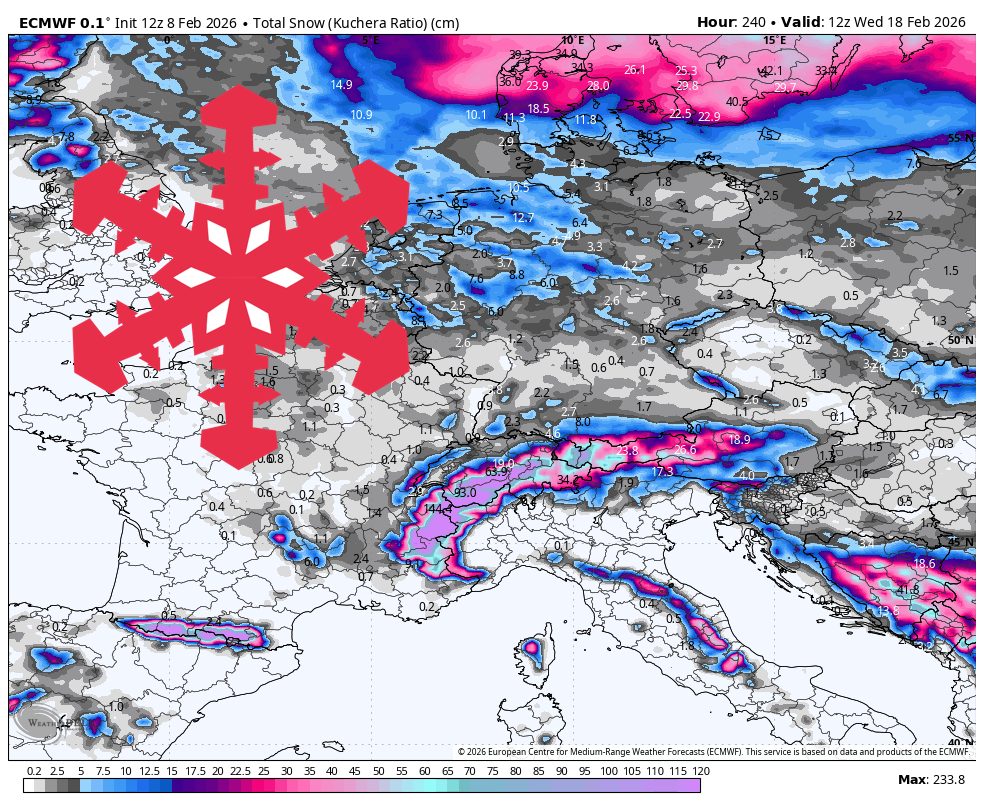
1 day agoEurope Snow Forecast European Alps Snow Forecast: 30-55 cm
Snow in the European Alps is expected through Saturday, with strongest confidence Monday night to Saturday night and highest totals in northern and western high terrain.