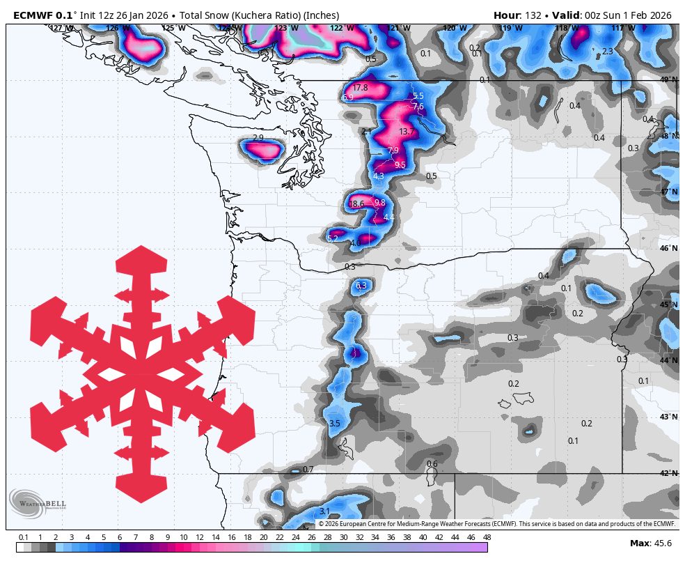
"Tuesday night through Thursday is the main window, with snow levels steadily climbing as precipitation spreads inland and focuses on the Cascades and Coast Mountains. In Washington and Oregon, expect the most consistent snowfall from late Tuesday night into Wednesday night, then lighter wraparound into Thursday at the higher ski areas. Snow levels generally rise from roughly 3,000-4,500 feet early to around 4,500-6,400 feet by Thursday, so lower base areas can see periods of wet snow or mixed precipitation."
"A midweek storm cycle brings the Pacific Northwest a round of modest snowfall with rising snow levels, then the pattern leans warmer with fewer clean powder windows heading into early February. The best midweek accumulation favors higher terrain, with Whistler and Oregon's upper elevations leading totals, while lower-elevation Washington passes flirt with mixed precipitation as snow levels climb. Snow quality trends dense to moderate with this storm, and wind will be the main on-mountain limiter at the most exposed Cascade volcano resorts."
A midweek storm cycle will produce modest snowfall across the Pacific Northwest from Tuesday night through Thursday, focusing on the Cascades and Coast Mountains. Higher terrain, particularly Whistler and Oregon's upper elevations, will receive the best accumulations while lower-elevation Washington passes may experience wet or mixed precipitation as snow levels rise. Snow-to-liquid ratios largely sit around 7-11:1, producing denser, more supportive powder; Whistler ratios may fall to 6-10:1 near freezing. Strong southwesterly ridge-top winds will be the main on-mountain limiter at exposed Cascade volcano resorts. Light to moderate wraparound snow continues into Friday with continued warming and heavier lower-elevation snow.
Read at SnowBrains
Unable to calculate read time
Collection
[
|
...
]