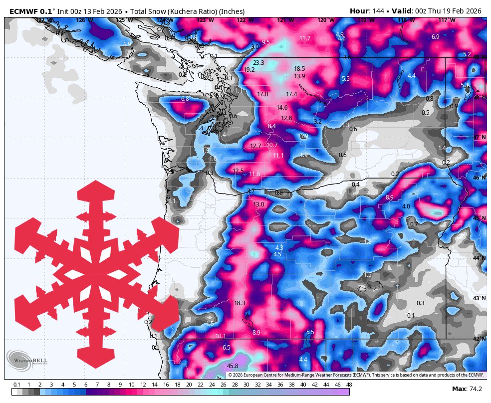
"A Friday-through-weekend system refreshes the Pacific Northwest mountains, and then a colder, more unsettled pattern keeps the door open for a much bigger snow cycle into next week. Snow levels trend downward through the weekend, helping keep most resort terrain in snow and setting up improving quality as colder air settles in. After a brief lull, additional rounds of mountain snow look likely, while the timing, snow levels, and wind impacts become less certain with each passing day."
"Friday into early Sunday brings the clearest, highest-confidence snowfall of the forecast, with good agreement on the onset, lowering snow levels, and generally manageable winds. The models show modest spread in intensity, and they still converge on a solid refresh focused on higher terrain. Snow arrives from northwest to southeast, reaching Whistler and Mt Baker first and then spreading into the Cascades later Friday."
A Friday-through-weekend system refreshes the Pacific Northwest mountains and a colder, unsettled pattern follows, keeping the door open for a larger snow cycle into next week. Snow levels trend downward through the weekend, which helps keep most resort terrain in snow and improves quality as colder air settles in. Friday into early Sunday brings the clearest, highest-confidence snowfall, with snow arriving northwest to southeast. Storm totals at resorts generally range from 3 to 12 inches, with the best odds for higher totals at Mt Baker, Timberline, and Mt Bachelor. Early next week brings repeated Pacific waves and colder air, increasing snow quality while timing and wind impacts remain uncertain.
Read at SnowBrains
Unable to calculate read time
Collection
[
|
...
]