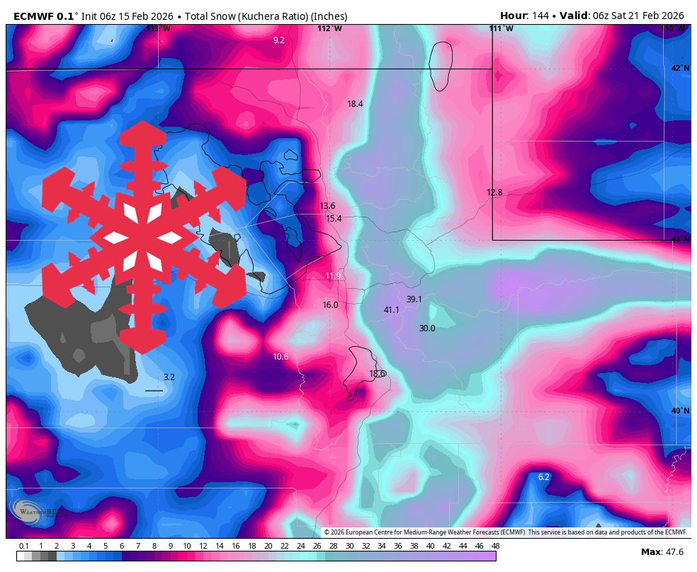
"WeatherUtah is lining up a windy, multi-day storm cycle from Monday night through Saturday, with storm totals ranging from 20″-60″ and the Cottonwoods favored for the deepest turns. Sunday and Monday stay mostly dry, but winds ramp steadily ahead of the first wave and set the stage for a busy midweek. Snow levels start high Monday night, then crash quickly into Tuesday, and that cold trend sticks through the heart of the storm."
"Monday night into Tuesday morning starts things off with a windy push and 5″-12″ of dense snow for most mountains. Southerly to southwesterly ridgetop winds ramp Sunday into Monday and stay elevated into the first half of the storm cycle. The models are converging well on the Monday-evening onset and on a quick snow-level crash into Tuesday, which keeps any lower-elevation rain or mix fairly brief."
Windy, multi-day storm cycle will impact Utah Monday night through Saturday with totals of 20–60 inches and the Cottonwoods favored for the deepest turns. Sunday and Monday are mostly dry while ridgetop winds ramp ahead of the first wave. Snow levels start around 7,000–8,000 feet Monday night then crash to roughly 4,500–5,000 feet by Tuesday morning, switching lower elevations to snow. Initial snowfall will be dense with SLRs near 8–12:1, improving as colder air deepens. The best mix of intensity and improving snow quality arrives Tuesday night through Thursday, with a lighter, colder finish Friday into Saturday. After the weekend quieter conditions should prevail before a lower-confidence storm window next week.
Read at SnowBrains
Unable to calculate read time
Collection
[
|
...
]