"WeatherWind and snow return to New Mexico late Monday night, and a storm train runs Tuesday through Saturday with the best totals in the northern mountains. Snow levels drop quickly once precipitation starts, and snow quality improves as colder air filters in through the second half of the week. Expect several rounds of strong west to southwest wind, with Tuesday looking like the toughest day for exposed lifts."
"Sunday and Monday stay dry and mild, with high clouds and strengthening southwest ridge winds ahead of the pattern change. The models all keep New Mexico's resorts quiet through Monday daylight, then bring a fast ramp-up in wind late Monday night into Tuesday. Temperatures run warm enough early in the week that surfaces can feel springy during the day, especially on sun-exposed aspects, then trend steadily colder once the midweek system arrives."
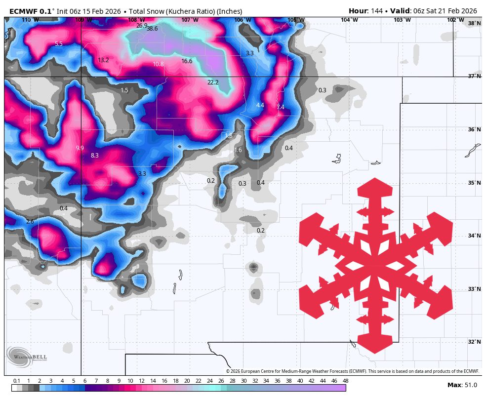
"Snow levels show strong agreement on a rapid drop, starting around 8,000 to 9,500 feet early Tuesday and falling quickly toward 5,500 to 6,500 feet by Tuesday afternoon, with lower levels in later pulses. Snowfall intensity carries more spread, with the GFS and the GDPS generally leaning wetter than the ECMWF and the AIFS at times, and the ICON varying more from burst to burst, so exact resort-by-resort distribution stays somewhat uncertain even though the overall event is high confidence."
Wind and snow return to New Mexico late Monday night, initiating a storm train from Tuesday through Saturday with the best totals in the northern mountains. Sunday and Monday remain dry and mild with strengthening southwest ridge winds before a late Monday-night-to-Tuesday ramp-up in wind. Temperatures feel springlike on sun-exposed slopes early in the week, then trend colder as the midweek system arrives. The Tuesday–Thursday storm produces the steadiest mountain snow and the most disruptive winds, with snow levels falling rapidly from roughly 8,000–9,500 feet to about 5,500–6,500 feet by Tuesday afternoon. Forecast models differ on intensity and distribution, and snow quality improves as colder air filters in mid- to late-week. A shift toward warmer, drier late-February conditions reduces the odds of another major powder cycle after the weekend.
Read at SnowBrains
Unable to calculate read time
Collection
[
|
...
]