#snow-removal
#snow-removal
[ follow ]


New York City
fromNews 12 - Default
2 months agoCity council approves pilot program to improve NYC street cleanliness, snow removal
New York City Council approved a pilot program to enhance street cleanliness and snow removal from public spaces including bus shelters and bike stations, with private owner accountability and results reporting in two years.
Canada news
fromwww.cbc.ca
2 months agoToronto spent nearly $1M to remove snow from Don Valley Parkway, Gardiner Expressway: staff | CBC News
Toronto spent nearly $1 million on emergency snow removal from curb lanes on major expressways to prevent vehicles from launching over guard rails during winter.
Canada news
fromwww.cbc.ca
2 months agoSnowbanks are still blocking parking on some streets more than a month after Toronto's last big storm | CBC News
Toronto residents struggle to find on-street parking over a month after a major snowstorm due to uncleaned curbside snowbanks, affecting both residents and local businesses.
New York Islanders
fromNew York Post
2 months agoShovels blazin' as NY, NJ residents defend parking spots in blizzard's aftermath - with some even threatening to slash tires
During heavy snowfall, motorists aggressively defend shoveled parking spots on public streets using intimidating signs, furniture, and threats to deter others from taking their spaces.
fromBoston.com
2 months agoThe story behind this viral photo of an unplowed Fall River street
Our street is still unplowed. Hopefully we get it plowed at some point today, but I'm not holding my breath. I realize you can't plow every street all at once. I get that. But, I mean, the effort of this city during the snowstorm is pretty pathetic.
US news
fromBoston.com
2 months agoBoston ends snow emergency parking ban; residents can use space savers until Thursday evening
A significant amount of snow was cleared overnight, and large-scale removal began this morning. Crews removed 165 loads totaling 4,620 cubic yards of snow. Thank you to all our city workers for the nonstop hard work to keep everyone safe, and thank you to our residents for doing your part.
Boston


fromArchitectural Digest
3 years ago7 Snow Removal Hacks to Get You Through the Rest of Winter
Electric snow blowers are corded and good for clearing light to moderate snow off patios, porches, walkways, and small-to-medium-size driveways. High-voltage batteries power cordless snow blowers, which are effective on light, moderate, and heavy snow on walkways and driveways. Gas snow blowers are more powerful and can run longer without needing a recharge, which makes them better suited for large properties.
Gadgets


fromwww.cbc.ca
3 months agoToronto police have issued over $2M in tickets to drivers for parking on snow routes | CBC News
Toronto police officers issued more than $2 million in parking tickets to drivers who parked their vehicles along designated snow removal routes in the last two weeks of January, data shows. Police parking enforcement officers handed 21,508 tickets to drivers who parked on snow routes in the city from Jan. 15 to Jan. 30, with each ticket carrying a fine of $100, according to the Toronto Police Service.
Canada news

fromThe American Conservative
3 months agoAbolish ICE? Dems Can't Even Plow Snow
"Closer to the nation's capital, however, people have been muttering "abolish ice." The denizens of the Acela Corridor aren't without their own misgivings about assertive immigration enforcement. But even the most hardened member of the Resistance-frozen solid-has to wonder why it takes two weeks after a moderate snowstorm for a Democratic-controlled city to plow a street or clear a sidewalk."
Right-wing politics
New York City
fromStreetsblog
3 months agoFLASHBACK: What Happened To Car-Free 'Snow Routes' - And Could They Have Helped City Clear the Streets? - Streetsblog New York City
Removal of snow route signs in 2013 let drivers leave cars on streets, hindering effective plowing and prolonging snow-clearing after storms.
fromBrooklyn Eagle
3 months agoBay Ridge Facebook group helps locals dig out of snow amid frigid temps
The shoveling connection was established by me in 2022 after I noticed on the Bay Ridge Talk page seeking people to shovel while also seeing separate posts about people looking for work to shovel,
Brooklyn
fromThe New Yorker
3 months agoWhat Happens When the Snow Doesn't Melt?
This past week in New York City, fifteen inches of snow fell and more than twenty-two hundred snowplows pushed it away. Twelve thousand miles of sidewalk were shovelled. Two hundred and nine million pounds of salt were spread, and, after it got really bad, two hundred thousand gallons of calcium chloride, a chemical ice melt, were deployed. Sometimes the work you do leaves its mark; sometimes it doesn't.
New York City
fromBrooklyn Eagle
3 months agoDeep freeze tests city sanitation workers
Given that the same sanitation workers who pick up trash have been clearing the foot of snow and ice that fell last Sunday, we are about one day behind on collection, and we ask for patience from New Yorkers while we catch up,
Brooklyn
New York City
fromwww.amny.com
3 months agoStill digging out: Mamdani says city has cleared mounds of snow from 100% of bus stops with shelters, days after winter storm amNewYork
City cleared snow from 100% of bus shelters and about 12,986 of roughly 14,000 bus stops (≈92%), plus crosswalks and fire hydrants after the Jan. 25 storm.
fromIntelligencer
3 months agoWhy Does D.C. Suck So Bad at Snow Removal?
After last weekend's snowstorm, streets in cities across the East Coast are crowded with dirty snow piles that squeeze pedestrians into single-file corridors and force them into gross half-frozen puddle swamps at intersections. But of the major metros, only Washington, D.C., closed its schools through Wednesday, finally reopening on Thursday with a delayed start time - all this despite receiving just six or so inches (plus, to be fair, a treacherous coating of ice on top).
Washington DC
New York City
fromCbsnews
3 months agoBrooklyn Snow Patrol program helps seniors dig out, and brings neighbors together
A Brooklyn volunteer program pairs neighbors with senior homeowners to clear snow, easing financial, safety, and emotional burdens while fostering cross-generational community connections.
fromStreetsblog
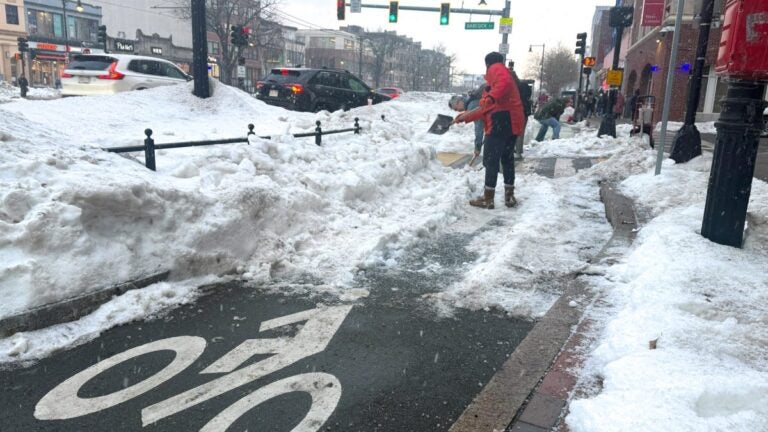
3 months agoWednesday's Headlines: Plowed In Edition - Streetsblog New York City
The drum we started beating on Monday morning - that pedestrians and people in wheelchairs are treated like garbage whenever it snows in this town - was still pounding out fat disco beats all through Tuesday. First, we couldn't stop watching this Reddit video, which is like the Zapruder film of all the ways that pedestrians (and conscientious property owners who do their best to meet their shoveling responsibilities) are fucked:
New York City

Canada news
fromwww.theguardian.com
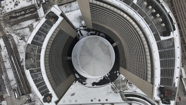
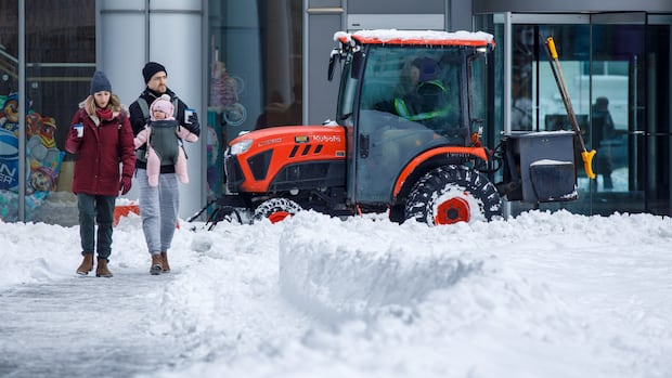
3 months agoToronto digs itself out after largest snowfall in city's history
Toronto faces multi-day snow cleanup after historic snowfall, widespread travel disruptions, numerous collisions, airport shutdowns, and prioritized clearing of main roads while residential streets await.
New York City
fromwww.amny.com
3 months agoMAMDANI'S FIRST 100 DAYS: Mayor vows uniform response citywide to potentially historic winter storm amNewYork
Mayor Zohran Mamdani faces a major operational test as a 12–18 inch winter storm threatens New York City, prompting citywide snow-response preparations for hazardous travel and cold.
fromStreetsblog
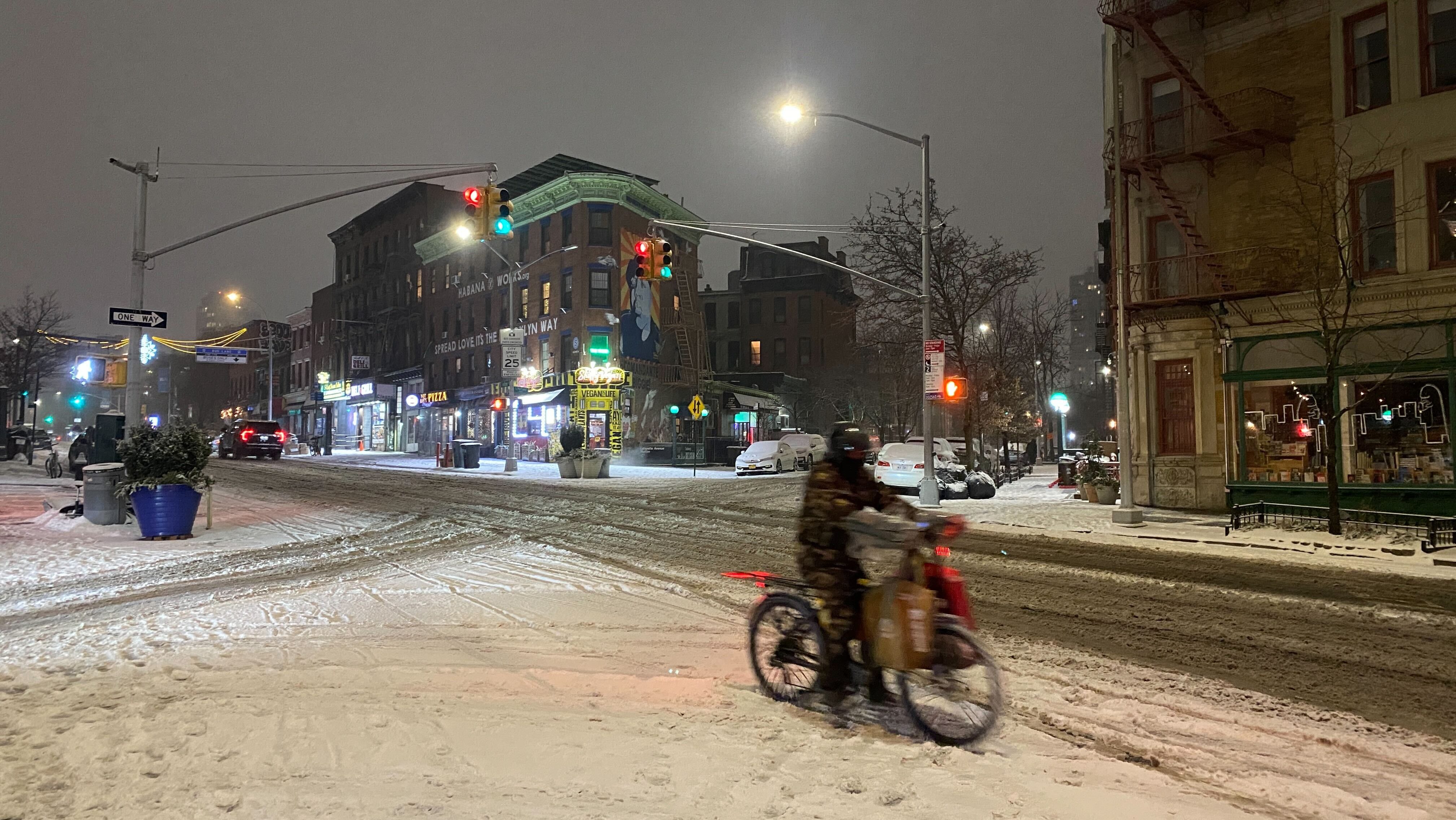
3 months agoQueenshorror Bridge: Two Days After Minor Storm, Span Is An Ice Sheet - Streetsblog New York City
"Solid ice." "Outrageous." "Not fair." These are some of the comments bike riders posted on Tuesday night and earlier today about conditions on the Queensboro Bridge bike lane more than two days after a fairly insignificant snowfall ended on Sunday night. Photographic evidence suggests that the Department of Transportation did not fully clear the way for riders - many of whom are delivery workers - on the second-busiest East River bridge (and the only one to link Queens directly to Manhattan Island).
New York City
Relationships
fromSlate Magazine
3 months agoHelp! I Wanted to Extend a Simple Thank You to a Neighbor. But They Took Advantage of My Generosity.
Neighbor shoveled unexpected snow; host offered lunch but felt resentful when partner joined and ordered pricier items; host wants clear, fair repayment expectations.
Canada news
fromwww.cbc.ca
4 months agoSnowstorms expose accessibility gaps for people with disabilities: Toronto advocates | CBC News
Snow accumulation creates mobility and transit barriers that make Toronto winter conditions inaccessible for people with disabilities, requiring regulatory standards and proactive municipal planning.
fromApartment Therapy
4 months agoThis No-Shovel Method for Clearing Snow Actually Works (It's So Smart!)
Showcased in a video by Kentucky-based TikTok user @pstevenson (which was reposted by the weather app Accuweather), this method of snow removal relies on covering the area - in this case, his car and walkway - with a large, thick plastic sheet or tarp before it starts to snow. For his car, he secures a part of the sheet inside of the door to prevent it from sliding off.
Remodel
fromNew York Post
6 months agoDSNY debuts 'first line of defense' trucks to salt NYC highways ahead of looming snowy winter
The sanitation department unveiled four new brine trucks - upping its fleet to 17 - to not only prepare the on and off ramps of major New York City highways, but also cover additional miles of highway for the first time. "We're looking at new technology ... every single year to make this operation run smoother and more efficient," DSNY Chief of Bureau Operations James Miglino said at the agency's Hudson Square garage.
New York City
[ Load more ]