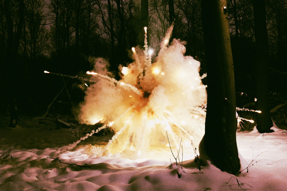
#dry-thunderstorms
#dry-thunderstorms
[ follow ]
#weather #climate-change #southern-california #thunderstorms #california #heat-wave #drought #bay-area #wildfires


fromABC7 Chicago
4 days agoSevere storms accompanied by tornadoes damage communities from the Plains to the Midwest
Authorities in Kansas reported several people with minor injuries after storms passed through on Monday. Three people were left with minor injuries in rural Franklin County, about 50 miles southwest of Kansas City.
Canada news
fromwww.theguardian.com
4 days agoHeatwave threatens to shatter high-temperature records across eastern US
The near-record temperatures are expected to last into this weekend, forecasters say. While it's not unprecedented to see high temperatures climb toward 90F on an April day, the length of such an April heatwave is rarely seen.
Washington DC
fromsfist.com
6 days agoSunday Links: California Hit With Thunder, 30,000 Lightning Strikes Over the Weekend
After 21 hours of talks, US and Iran did not reach a deal to end the war, as Vice President JD Vance said talks stalled after the US made a final offer pushing for stronger guarantees that Iran won't develop nuclear weapons.
US news
fromLos Angeles Times
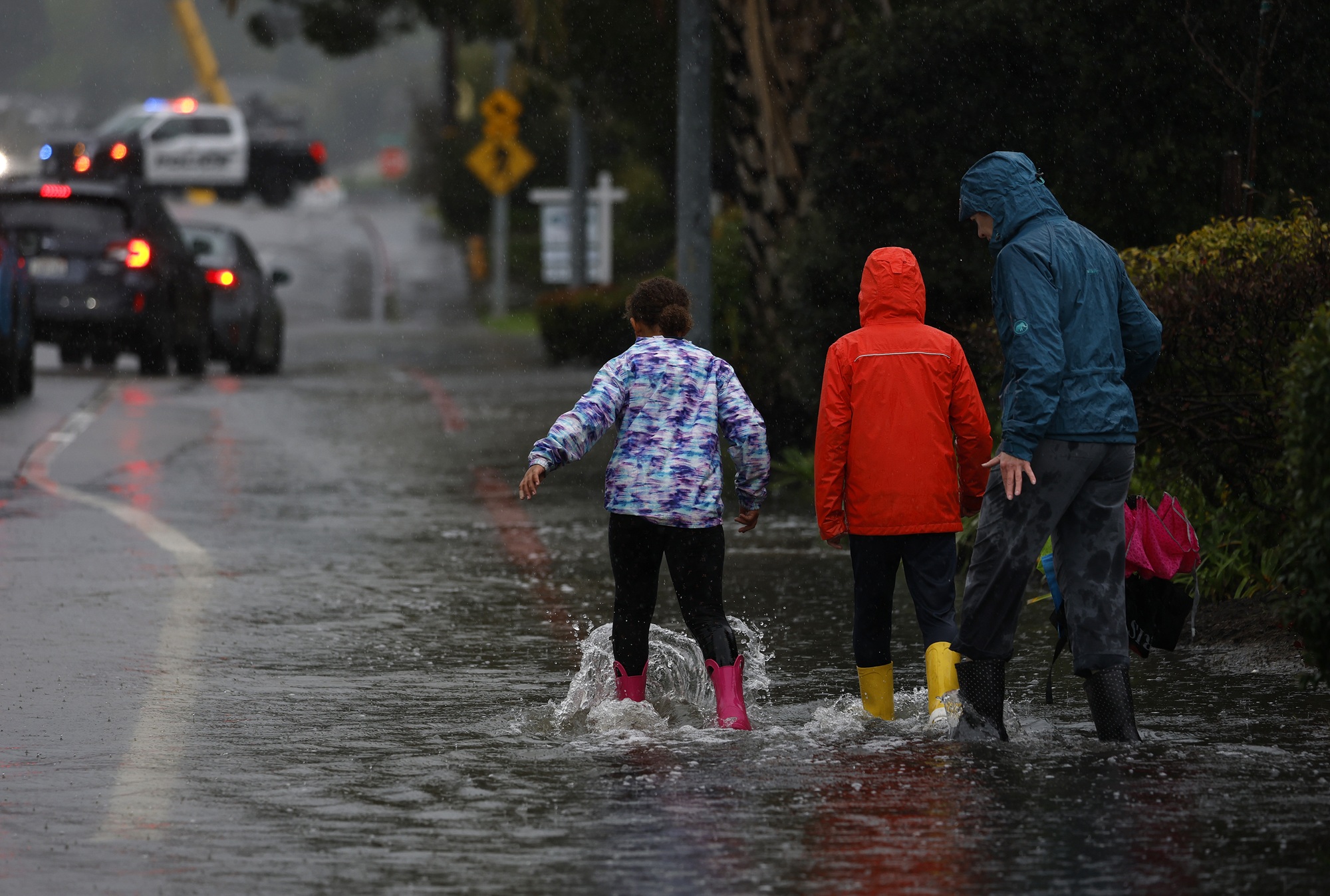
1 week agoRain - and maybe thunderstorms - are expected in Los Angeles this weekend
Parts of Los Angeles will probably see rain after 11 p.m. Saturday, with scattered showers anticipated on Sunday afternoon before 2, and a potential for thunderstorms in some parts of the city.
Los Angeles
fromABC7 San Francisco
3 weeks agoBay Area weather radar network aims to improve storm forecasting, flood prep and drought planning
"This is going to help fill that gap in minutes to hours lead time that's vital to know where the heaviest rain is going to hit," Ralph said. "And when and what communities are going to be affected so people in the preparedness community and water resource management community can take action to help protect people's lives and property."
San Francisco
fromSnowBrains
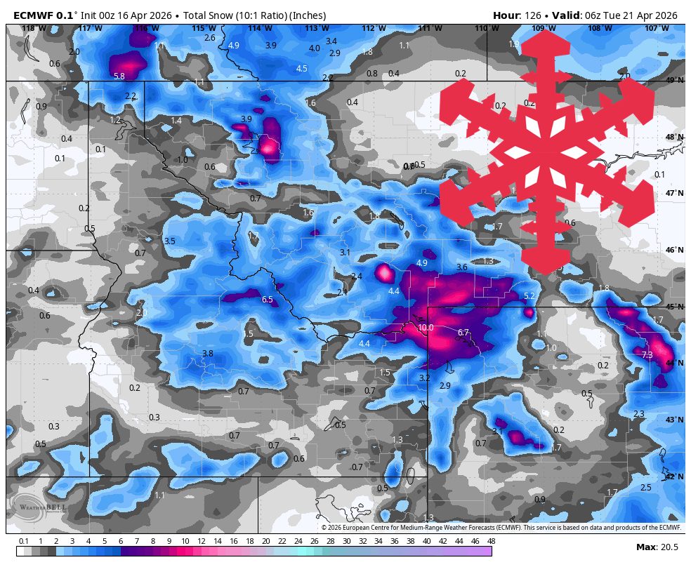
5 days agoSnowBrains Forecast: Up to 1 Foot for Colorado Through Saturday - SnowBrains
The storm already underway across most of the state keeps snow going through today, then winds down overnight and early Wednesday. The guidance is well clustered on that timing and on snow levels holding between 6,500 and 8,500 feet while it is snowing.
Snowboarding


fromThe Washington Post
1 month agoIt's so hot in the West that temperatures may even break April records soon
Not only will temperatures break March monthly records, but this heatwave will even break April records. Over the next week, around 800 high temperature records are forecast to be neared, tied or broken at 165 locations in Western and Central states - some by more than 10 degrees - with unusual warmth set to linger into late March.
US news
LA food
fromFast Company
1 month agoExtreme March heat wave will scorch Los Angeles and the Southwest this week. The long-term consequences could devastating
An unprecedented heat wave will strike the American southwest this week, with temperatures 15-25 degrees above normal and potential record-breaking highs across multiple states.
LA food
fromABC7 San Francisco
1 month agoDeath Valley wildflowers blooming in the driest place in North America, but not for long
Death Valley experiences a rare superbloom of wildflowers, transforming the desert landscape into vibrant carpets of color due to exceptional rainfall and warm temperatures over six months.
US news
fromFortune
1 month agoThe weather sampler platter will wallop the U.S. this week: extreme heat in the south, downpours and snow in the east-with a side of the polar vortex | Fortune
Nearly all U.S. regions face extreme weather including record heat in the Southwest, snow in the Great Lakes, Arctic cold in the Midwest and East, and heavy rain in Hawaii within the coming days.
#march-heat-wave

California
fromABC7 San Francisco
1 month ago'Concerning': Bay Area sizzles in March heat wave, bringing fire danger and AC issues
An unprecedented March heat wave with record temperatures is straining Bay Area infrastructure, causing air conditioning systems to fail prematurely and raising wildfire concerns due to dry conditions.


#heat-wave
California
fromLos Angeles Times
1 month agoSouthern Cailfornia's winter ends with a record-breaking heat wave
A historic late-winter heat wave across Southern California is breaking numerous daily and all-time March temperature records, with inland areas reaching triple digits while coastal regions experience 80s and 90s temperatures.

#extreme-heat

Environment
fromwww.theguardian.com
1 month agoBlistering early-season heatwave threatens California and other western states
An early-season heatwave will bring temperatures 20-30°F above normal across western US states, threatening daily and all-time March records while intensifying drought concerns amid record low snowpack.
Snowboarding
fromSnowBrains
1 month agoThe Western U.S. Could See A Rare Wet Slab Avalanche Cycle Next Weekend - SnowBrains
A historic heat wave with temperatures 20-30 degrees above average could trigger rare wet slab avalanches in Colorado and Utah by introducing liquid water to weak layers in the snowpack.
Environment
fromLos Angeles Times
1 month agoCalifornia's snowpack was already meager. Now comes an extraordinary heat wave
California's Sierra Nevada snowpack is at 48% of average due to an extremely warm winter, with rapid melting accelerated by an incoming heat wave threatening the state's water supply.
California
fromLos Angeles Times
2 months agoFirst wave of nearly a week of rain hits Southern California. Snow expected for Mammoth, Tahoe
Southern California experienced heavy rains with flood watches, wind advisories, burn-scar evacuation warnings, and forecasts of significant rainfall and mountain snow this week.


fromLos Angeles Times
2 months agoAs teeth chatter across the U.S., Southern California is a hot spot: What to expect this week
While cold-stunned iguanas fall from trees in Florida and videos circulate of frozen "exploding" trees in the Northeast, Southern California is working up a sweat. A midwinter heat wave has descended on much of the state and is expected to spike temperatures as much as 20 degrees above normal in the coming week. The summer-like heat is thanks to a ridge of high pressure lingering high in the atmosphere that extends through the San Francisco Bay Area and into the Pacific Northwest.
Environment
fromWIRED
2 months agoRecord Low Snow in the West Will Mean Less Water, More Fire, and Political Chaos
"The numbers are really, really bad," Swain says. "If this were November, they might be less meaningful. We're not in November-we're heading toward mid-February. The normal numbers are pretty high. To be at half of them means that, in absolute terms, the deficit is large."
Environment


California
fromThe Mercury News
1 month agoSierra Nevada snowpack just 68% of normal after whiplash winter, but water supplies are OK, experts say
California's winter weather has been extremely volatile, with alternating dry and snowy periods leaving the Sierra snowpack at 68% of historical average despite previous wet years filling reservoirs above normal levels.
fromSFGATE
1 month agoThe surprising element that's boosting California's stubbornly low snowpack
SWE is the most important metric for all of our water resources. It's the metric that we deal with the most and the one that the entirety of the snow research and operations community is working to get right. So, seeing an increase in SWE like that, even if it's from mid-winter rain, is a great thing because that means we have more water stored in the snowpack moving forward.
California
fromThe Mercury News
2 months agoAnticipated rain will bring end to Bay Area's dry pattern
The pattern change began Monday when the barometric pressure surrounding the region started to fall gradually. That increase in low pressure is coming from the southwest and the air is flowing north, opposite of many winter low-pressure systems that dip in from the Pacific Northwest. As a result, light but steady rain is expected to start in Monterey County and the Central Coast late Tuesday morning. The rain is expected to reach the region closer to San Francisco sometime Tuesday night, Murdock said.
Environment
[ Load more ]