""This is going to help fill that gap in minutes to hours lead time that's vital to know where the heaviest rain is going to hit," Ralph said. "And when and what communities are going to be affected so people in the preparedness community and water resource management community can take action to help protect people's lives and property.""
""Having better data to prepare and to pass that information on to residents to start evacuations, if needed, earlier so they're safer," Rabbitt said."
""So when we think about water storage and flood control, understanding hyper-local precipitation information is crucial for our water supply here," Thur said."
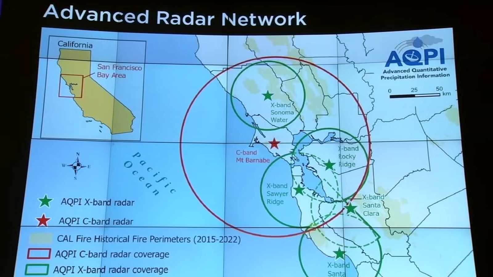
The San Francisco Bay Area has launched the Advanced Quantitative Precipitation Information (AQPI) Network to improve rainfall predictions. This radar network provides updates every 1 to 2 minutes, helping local agencies prepare for heavy rain and potential flooding. Experts emphasize the importance of timely data for evacuation plans and water resource management, particularly in drought-prone areas. The network aims to fill gaps in existing radar systems, offering critical information to protect lives and property during severe weather events.
Read at ABC7 San Francisco
Unable to calculate read time
Collection
[
|
...
]