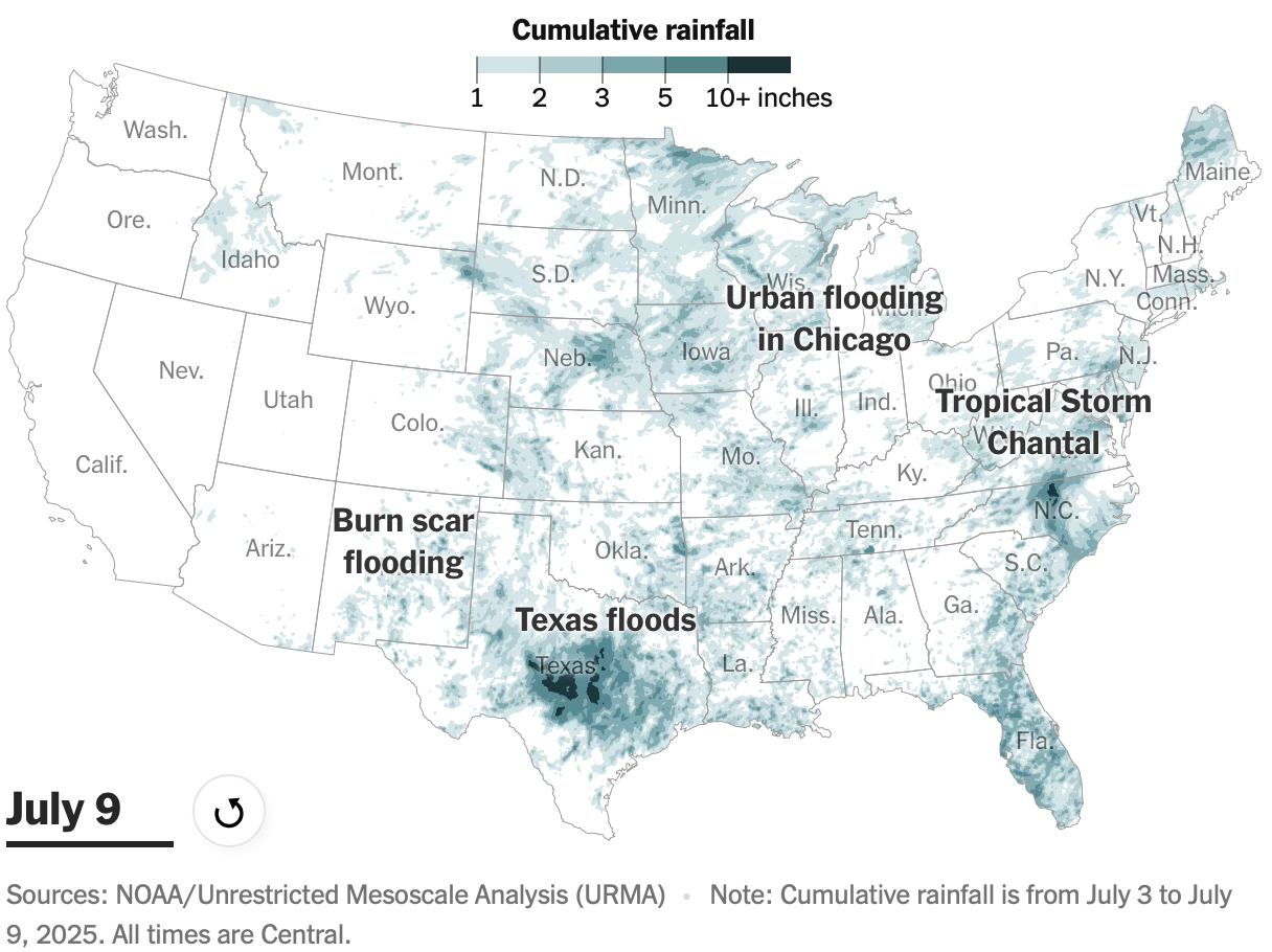
Flash floods occur in the United States every July, characterized by high temperatures and significant water vapor combined with atmospheric conditions that produce intense rain. Different geographical regions experience these floods in varying manners due to their unique terrain, influencing the rain's accumulation and flow. Comprehensive analysis of four major flood areas demonstrates these geographic impacts, illustrating how temperature and air conditions lead to drastic weather events during this time of year.
"In July 2025, the United States experiences 'flash flood month,' caused by high temperatures, increased water vapor, and specific air currents that create heavy rainfall."
"Geography and terrain play crucial roles in determining how and where the rain from these flash floods accumulates, exacerbating conditions in certain areas."
Read at FlowingData
Unable to calculate read time
Collection
[
|
...
]