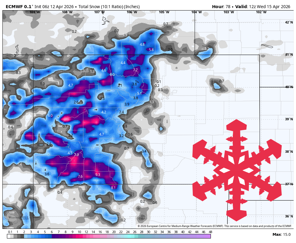
Colorado skiing conditions will remain spring-like and windy through Monday, with isolated alpine showers. A significant snow event is expected late Monday night through Tuesday night, bringing light to moderate snowfall. Snow levels will drop, leading to better accumulation. Wednesday and Thursday will be quieter, but another storm signal is anticipated for Friday and Saturday, though confidence in this forecast is lower. The best snow accumulation is expected at higher elevations, particularly at Wolf Creek.
"The best-defined part of the forecast runs from late Monday night through Tuesday night, when guidance converges on a cold front and widespread light to moderate mountain snow. Snow spreads onto the Divide Monday night, fills in on Tuesday, and then tapers from west to east Tuesday night into early Wednesday."
"Snow levels generally fall from around 7,500-8,500 feet early to near 6,000-7,000 feet by the end, so accumulation becomes less elevation-sensitive as the storm matures. Ratios mostly start around 8-12, which points to denser to fair snow at first, then improve into the low to mid teens Tuesday night."
Read at SnowBrains
Unable to calculate read time
Collection
[
|
...
]