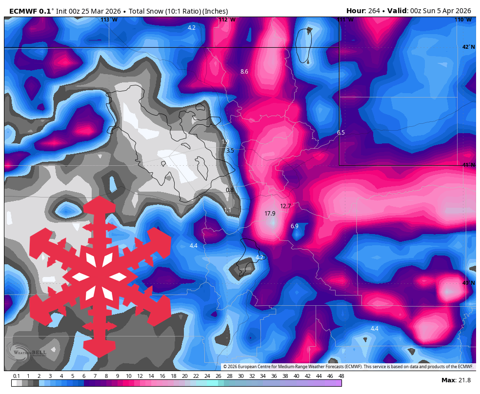
"The near-term story is heat, a mostly dry front, and periodic wind, but the more important ski-weather shift comes once the trough arrives. Snow should start out wet and elevation-sensitive, then cool enough for broader coverage and better quality later in the storm."
"Confidence is best from Tuesday evening, March 31, through Saturday, April 4, when every model turns Utah colder and unsettled even though the first burst still has timing spread."
"The models diverge on exact intensity and lull timing, but they converge on high initial snow levels around 8,000 to 9,000 feet, then a steady drop toward 5,000 to 7,000 feet later Thursday into Saturday."
Utah's weather will remain warm and mostly dry through the weekend, with record heat peaking on Wednesday. A shift to wintry conditions is expected next week, particularly from Tuesday night through Saturday, with snow accumulation ranging from 4" to 28" depending on elevation. The initial snow will be wet and elevation-sensitive, transitioning to better quality snow as colder air arrives. Wind gusts of 30 to 50 mph are anticipated, especially during the storm's stronger phases, leading to a solid refresh in favored high terrain.
Read at SnowBrains
Unable to calculate read time
Collection
[
|
...
]