A cold front is expected to impact Australia's mountains, bringing snowfall from Wednesday afternoon in Tasmania and late Wednesday night through Thursday night in Victoria and New South Wales. The forecast indicates 10-25 cm of snow for mainland resorts, with 5-10 cm at Mount Mawson and little to no snow at Ben Lomond. Conditions will remain quiet before the front, with snow levels around Mount Mawson between 800-1,300 meters. Winds may exceed 100 km/h, and snow quality will improve as temperatures drop.
"The active period supports base-building rather than a lift-served chase, with all Australia resorts still closed. Confidence is strongest from Wednesday May 6 through Friday May 8, when the model suite agrees on the frontal timing but still spreads on local intensity."
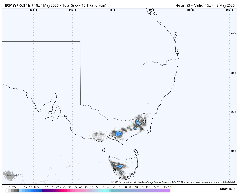
"Snow levels around Mount Mawson hover near 800-1,300 meters as snow falls, temperatures sit near -3 C to 1 C, and snow quality starts dense with SLRs around 4-10. Winds become a real factor there, with stronger solutions showing exposed gusts above 100 km/h."
"The main mainland burst arrives late Wednesday night and Thursday, and this is where the guidance is best aligned on timing. The spread is larger on intensity, with the heaviest signal over Mount Baw Baw and more moderate but widespread totals across the Victorian and New South Wales alpine terrain."
Read at SnowBrains
Unable to calculate read time
Collection
[
|
...
]