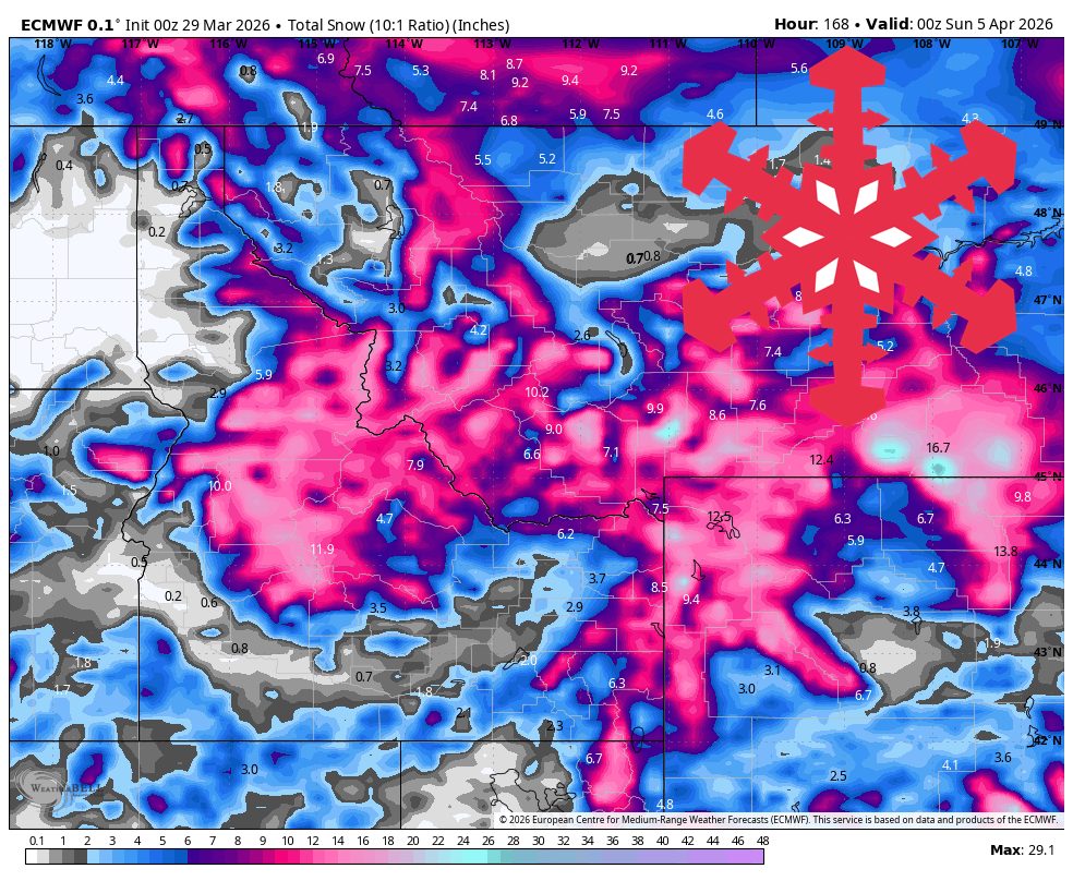
"From Wednesday into Saturday, guidance is converging on a widespread storm that should deliver 4-27 inches across the region, with the strongest open-resort upside at Big Sky, Grand Targhee, Brundage, and Jackson Hole."
"Timing agreement is solid on snow ramping up Wednesday, peaking Wednesday night through Thursday, then tapering to colder wraparound snow Friday into early Saturday."
"Sunday through Tuesday looks more like a transition than a true storm cycle, with only 1-5 inches of new snow favored at the Idaho Panhandle and northwest Montana resorts."
A major storm is forecasted from April 1 to April 4, delivering 12-24 inches of snow across the Northern Rockies. Confidence is highest during this period, with snow levels expected to drop significantly. Following this storm, milder spring conditions will return, with only light snow anticipated. The transition period from Sunday to Tuesday will see minimal snowfall, with 1-5 inches expected in some areas. Wind gusts may reach up to 60 mph in higher elevations, impacting conditions.
Read at SnowBrains
Unable to calculate read time
Collection
[
|
...
]