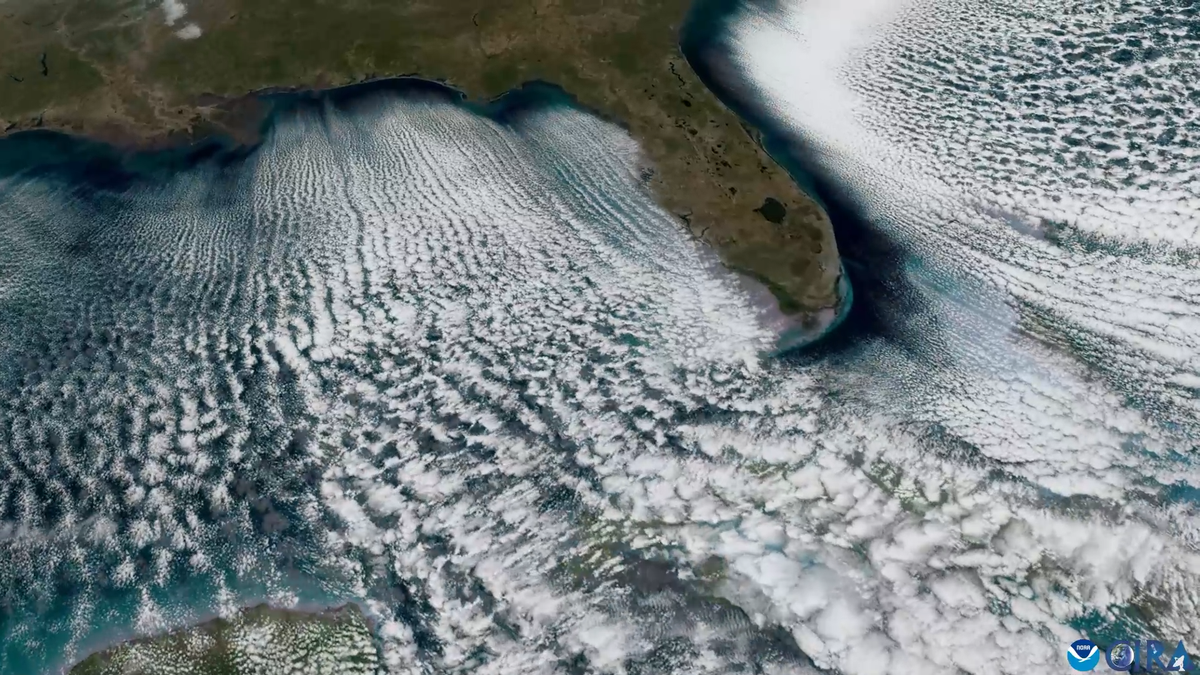
"As Arctic air plunged into sunny Florida this past weekend, it made for a mesmerizing sight in a satellite video: parallel lines of clouds colloquially called cloud streets streamed from the land over the ocean. Cloud streetsor horizontal convective rolls, as scientists call themform when cold, dry air flows above warm surface waterin this case, the Gulf of Mexico and the Atlantic waters near Florida."
"That cold air gets warmed up as it moves over the ocean's warmer surface and then rises. That rising air cools, and water vapor condenses. Eventually, the air hits a layer of warmer air above that acts like a lid and causes the rising air to roll overforming parallel cylinders of rotating air, according to a 2019 description of the phenomenon from NASA."
Arctic air plunging into Florida generated parallel cloud streets visible in satellite imagery. Cold, dry air moved over warmer Gulf and Atlantic waters, warmed at the surface, rose, and cooled, causing water vapor to condense. A warmer air layer above acted as a lid, forcing rising air to roll over into parallel cylinders of rotating air. The descending, drier air between rolls produced clear gaps that form long parallel cloud lines. Moisture uptake from the ocean takes time, creating a gap between the shoreline and where the rolls begin. The cloud streets generally align with the prevailing wind direction.
Read at www.scientificamerican.com
Unable to calculate read time
Collection
[
|
...
]