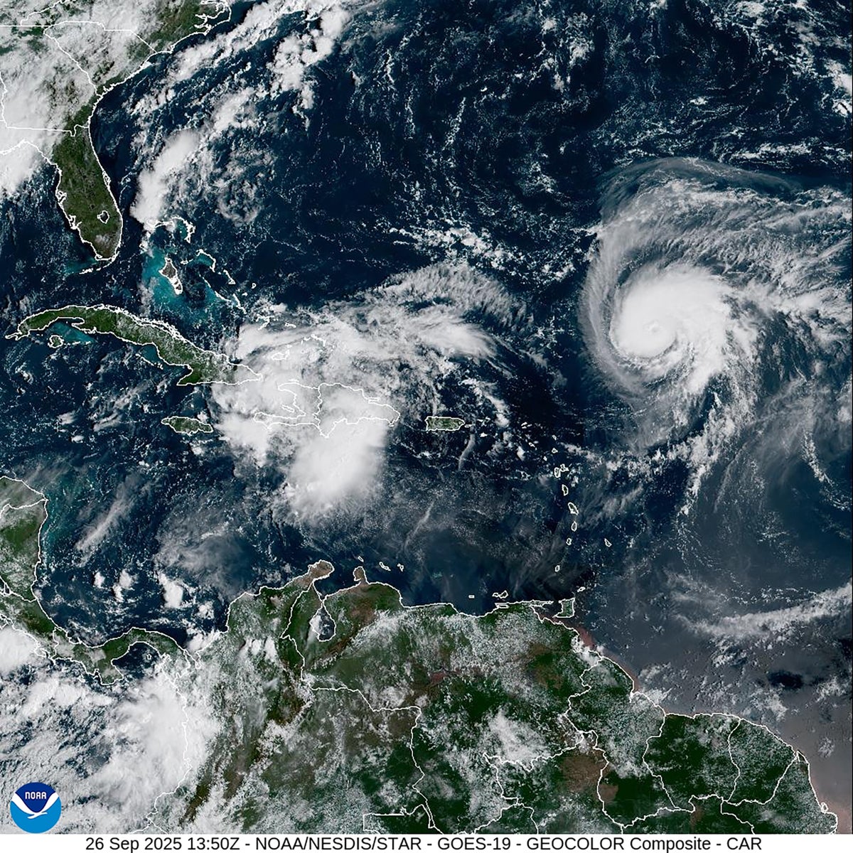
"The uncertain hurricane forecast hinges on a storm system that is currently located over Cuba and the Bahamas. Dubbed Potential Tropical Cyclone Nine, it will become known as Tropical Storm Imelda if the system's peak wind speeds reach 39 miles per hour. And as of 2 P.M. EDT on September 26, National Hurricane Center forecasters placed the probability of this occurring within the next 48 hours at 90 percent."
"But what would-be Tropical Storm Imelda might do once it achieves that status is much less certainfar less than usual. There's always inherent uncertainty at this point of a system, says Alan Gerard, a meteorologist who runs the consulting company Balanced Weather and who served in leadership positions at the National Oceanic and Atmospheric Administration for more than 20 years. This situation has a lot more complexity."
"That complexity is in part because of a second storm roiling the western Atlantic Ocean: Hurricane Humberto. With peak sustained wind speeds of 90 miles per hour, Humberto is currently a strong Category 2 hurricane and is expected to explode into a Category 3 hurricane overnight. This storm is currently moving west toward the Bahamas, although it is expected to veer north toward Bermuda before reaching the archipelago."
Potential Tropical Cyclone Nine near Cuba and the Bahamas has a high probability of strengthening to Tropical Storm Imelda within 48 hours. Forecasts assign a 90 percent chance of the system reaching tropical-storm-force winds, but the subsequent track and impacts remain highly uncertain. Concurrent Hurricane Humberto is a strong Category 2 storm with 90 mph winds and is expected to intensify to Category 3 while moving west toward the Bahamas before turning north toward Bermuda. Interaction between the two storms increases complexity and could alter Imelda's path and rainfall, elevating flood risk for the Carolinas early next week.
Read at www.scientificamerican.com
Unable to calculate read time
Collection
[
|
...
]