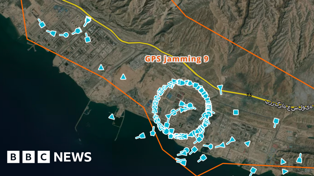
"I'm up to 35 different clusters. The clusters she mentions are weird circles of icons layered over the map, with each icon representing a real ship. But ships don't bunch together in tight, unnaturally perfect circles. And they also don't hover over land which is where some of the clusters appear. No, their GPS coordinates have been disrupted, obfuscating their true location."
"Wars are not just fought with bullets and bombs. Electromagnetic waves also do battle. Invisible to the naked eye, GPS jamming can cause significant disruption, hampered communications and potentially deadly accidents. In recent years, GPS jamming has affected aircraft in Europe, including a plane used by the President of the European Commission."
"We can't over-estimate the huge danger this places to maritime navigation and safety. Ships use AIS partly to avoid one another. It takes a long time for a 300m-long tanker carrying hundreds of thousands of tonnes of oil to turn or come to a stop and vessels can travel potentially many kilometres before."
GPS jamming is disrupting maritime navigation in the Strait of Hormuz, causing ships' Automatic Identification Systems (AIS) to broadcast false coordinates. Maritime intelligence analysts at Windward have identified dozens of unnatural vessel clusters appearing over water and land, indicating systematic GPS interference. This electronic warfare tactic creates dangerous conditions for shipping, as vessels rely on accurate positioning to avoid collisions. Large tankers require significant time and distance to maneuver, making GPS disruption particularly hazardous. Similar jamming has affected aircraft in Europe and is prevalent in the Ukraine conflict. Regional authorities, including Pakistan's National Hydrographic Office, have issued warnings about the interference affecting shipping operations.
Read at www.bbc.com
Unable to calculate read time
Collection
[
|
...
]