A statistical analysis used DataSF crash data and a Before-After-Control-Impact (BACI) design with rigorous controls to isolate effects of the Upper Great Highway closure. The impact area included Sunset/Parkside, Outer Sunset, Inner Sunset, and Golden Gate Park. Eight geographically separated neighborhoods served as controls, including Bernal Heights, Outer Mission, Excelsior, Oceanview/Merced/Ingleside, Portola, West of Twin Peaks, and Bayview Hunters Point. Simple year-over-year comparisons are misleading because crash rates fluctuate due to weather, economic conditions, return-to-office mandates, and major events. The BACI comparison shows no evidence that the closure increased crashes and may indicate a decrease.
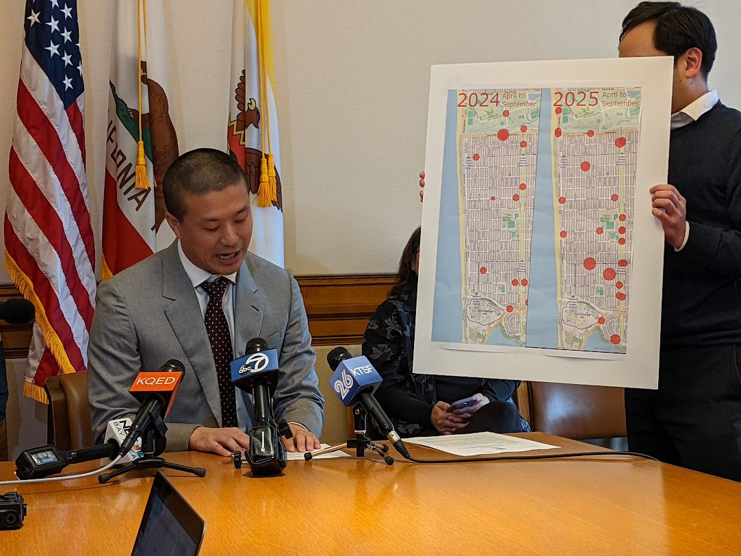
"Did the Upper Great Highway closure make Sunset neighborhood streets less safe? Supervisor Alan Wong claimed it did at a January 8 press conference, citing a simple year-over-year map comparison of crash data. But my analysis, using the same DataSF crash data with rigorous statistical controls, finds no evidence to support that claim, and if anything, the data suggest the opposite."
"Simple before-after comparisons like the one Supervisor Wong used are misleading because crash rates fluctuate year-to-year for reasons unrelated to any single road closure: weather patterns, economic conditions, return-to-office mandates, and major events all affect traffic citywide. To isolate the road closure's actual effect, I applied a Before-After-Control-Impact (BACI) design; a statistical method commonly used in ecological research that compares changes in the affected area to changes in unaffected control neighborhoods."
Read at Streetsblog
Unable to calculate read time
Collection
[
|
...
]