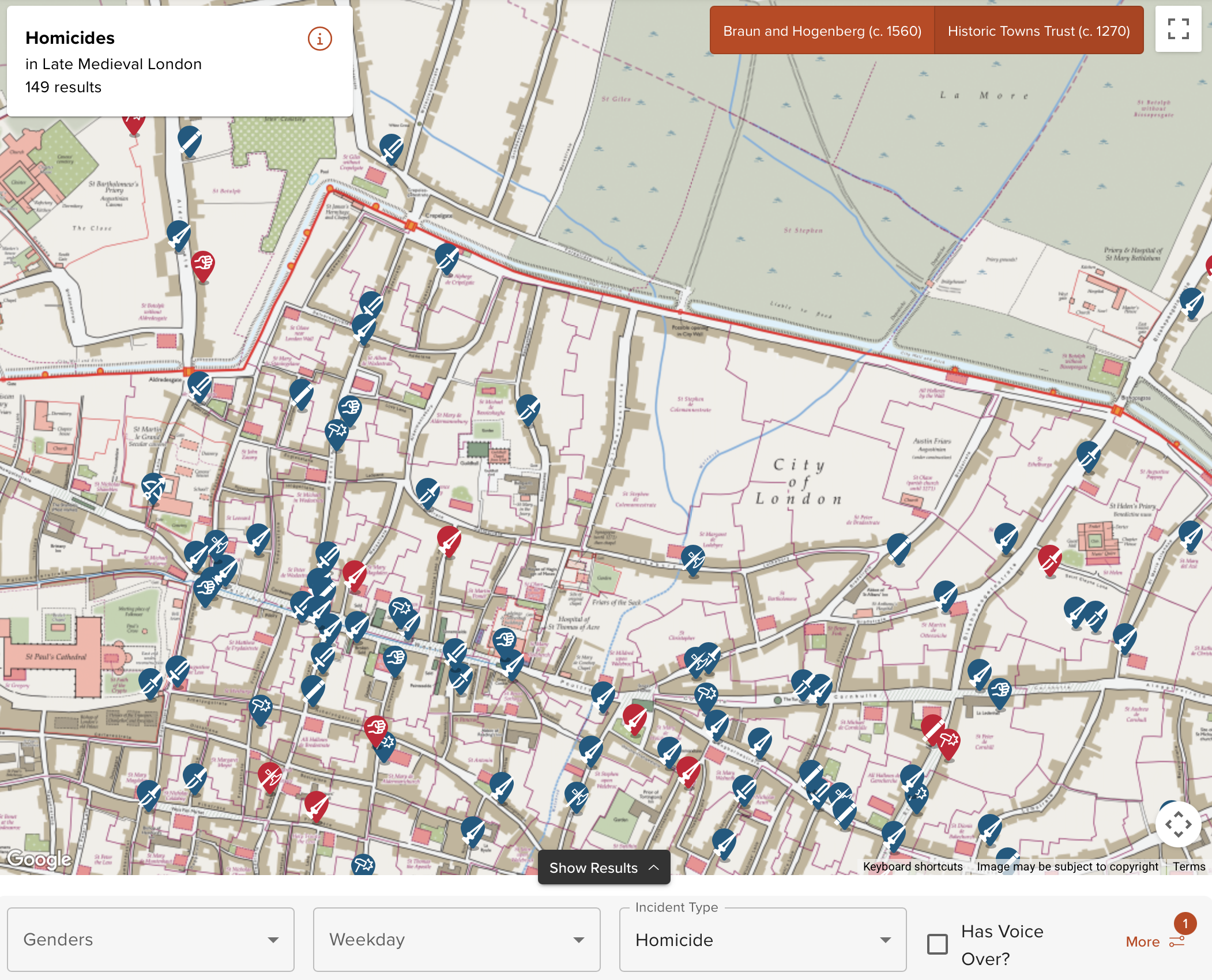
Medieval Murder Maps is an interactive project that visually represents homicide incidents from the Middle Ages. Users can click on markers within the maps of cities like London, York, and Oxford to discover detailed narratives of various murders. Each event is cataloged by weapon type and includes enthralling stories such as a revenge killing outside a tavern or an adolescent seeking sanctuary after committing murder. This project provides both educational content and engaging storytelling through its historical mapping of violent events in medieval society.
"The Medieval Murder Maps project provides a visual representation of homicide incidents during the Middle Ages, categorized by weapon and type, covering cities like London, York, and Oxford."
"Users can interact with the map to learn about specific stories of murder, including events such as a revenge killing outside a tavern or a fleeing adolescent after a killing."
"The project highlights historical events through detailed narratives linked to geographical locations, bringing medieval homicide stories to a contemporary audience in an engaging manner."
"With its focus on specific incidents and descriptive storytelling, Medieval Murder Maps engages users by combining historical facts with interactive technology, enhancing the understanding of social violence in medieval society."
Read at FlowingData
Unable to calculate read time
Collection
[
|
...
]