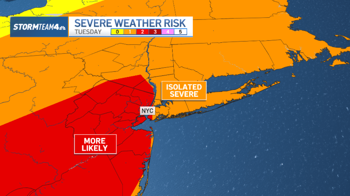
"The risk for severe storms is elevated - Level 2 on a scale from 1 to 5. Like Monday, damaging wind gusts upwards of 50 mph are possible, strong enough to knock down tree limbs and power lines."
"Where the heaviest rain sets up, two inches of rain or more is possible. The rest of the area will generally see between a half-inch and an inch of rain accumulation. Frequent lightning is also possible."
The tri-state area is experiencing the onset of summer, with July bringing expected temperatures in the 80s and high humidity. Severe storm risks are elevated, with a Level 2 on a 5-point scale, predicting damaging wind gusts exceeding 50 mph. Quick-hitting storms are likely in the afternoon, bringing localized heavy rain, potential flash flooding, and strong winds. Rain accumulation will vary, with some areas receiving two inches or more. Following the storms, a cold front will bring lower humidity and dry weather, especially for the Fourth of July.
Read at NBC New York
Unable to calculate read time
Collection
[
|
...
]