"Iran sits on the line where the Arabian tectonic plate, which hosts Saudi Arabia and the Persian Gulf, crunches into the Eurasian plate. This continent-to-continent crash has rucked up the earth to form the Zagros, a long line of mountains in Iran that push down on the Arabian plate and flex it like a bent ruler. The flexing creates a low point in Earth's crust called a foreland basin, which traps massive amounts of hydrocarbons."
"It's a combination of geological facts that leads to these huge oil and gas reserves in the Middle East on both sides of the Persian Gulf, says Mark Allen, a professor of Earth sciences at Durham University in England. Hundreds of millions of years ago, the northern edge of what is now the Arabian plate was a passive margin, acting as a boundary between continental and oceanic crust that is tectonically quiet."
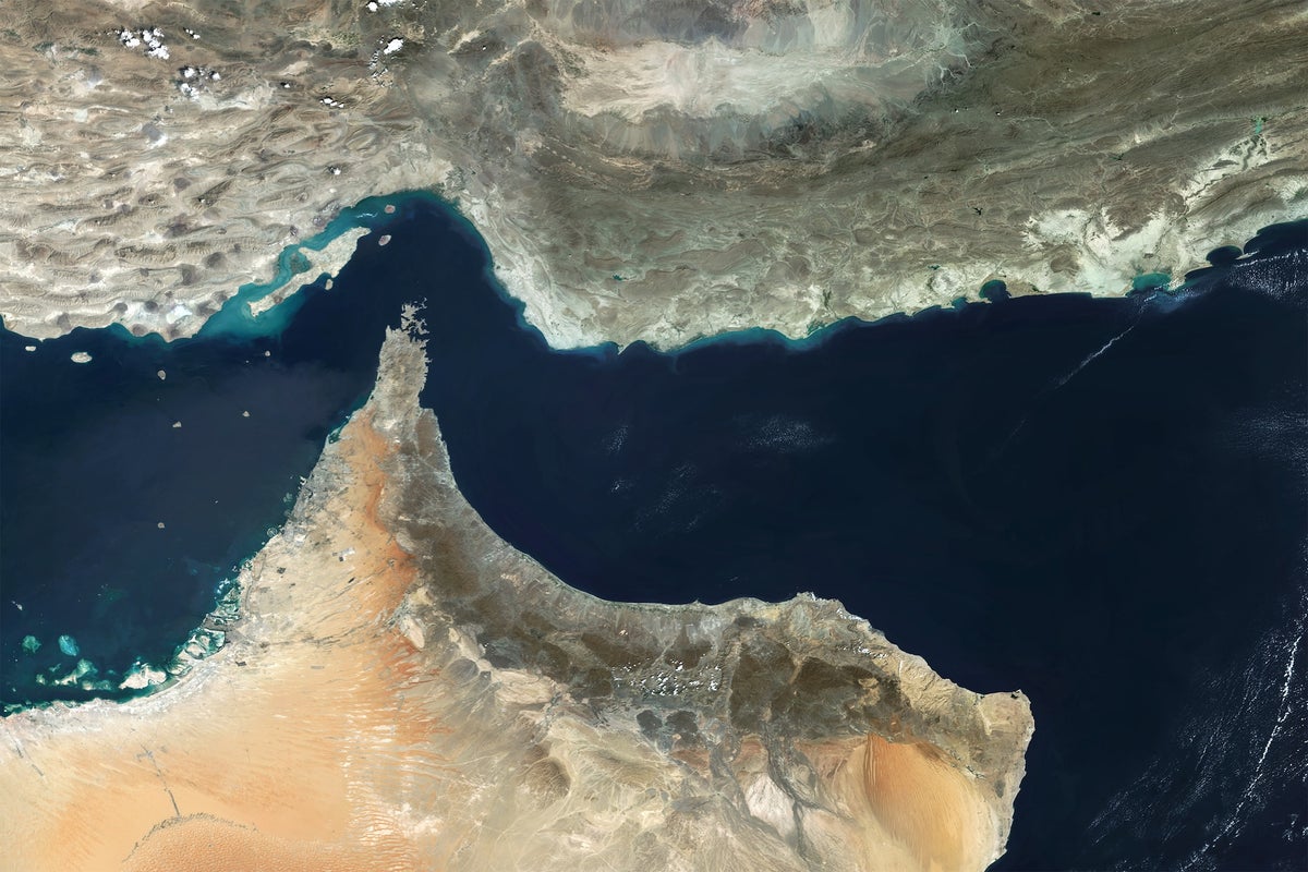
The Strait of Hormuz, through which one-fifth of global oil and liquefied natural gas shipments pass, became effectively closed following U.S. and Israeli attacks on Iran, causing energy prices to spike. The strait's narrow configuration stems from geological processes spanning millions of years. The Arabian tectonic plate collides with the Eurasian plate, creating the Zagros Mountains in Iran. This continental collision flexes the Arabian plate, forming a foreland basin that traps enormous hydrocarbon reserves while also collecting water to create the Persian Gulf. This same geological mechanism that produced the narrow strait also generated the region's vast oil and gas deposits on both sides of the gulf.
#tectonic-plate-collision #persian-gulf-geology #hydrocarbon-deposits #strait-of-hormuz #geopolitical-energy-crisis
Read at www.scientificamerican.com
Unable to calculate read time
Collection
[
|
...
]