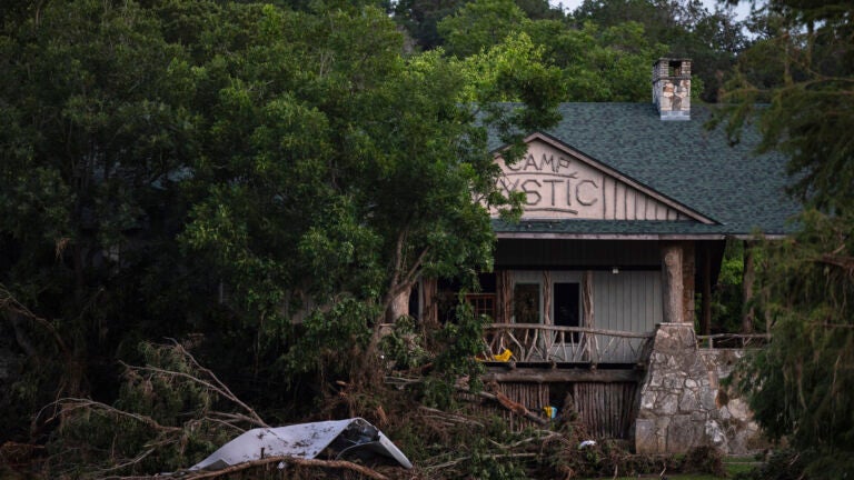
The federal regulators allowed Camp Mystic to operate and expand despite being in a 100-year flood zone, resulting in tragic consequences. The camp is situated in a low-lying area along the Guadalupe River and was designated as a 'Special Flood Hazard Area' by FEMA in 2011, necessitating flood insurance and strict regulations. A significant flood occurred on July 4, exceeding the expected 100-year flood levels, resulting in the loss of 27 campers and staff. Critics find it alarming that exemptions were granted for such a vulnerable location.
"Federal regulators repeatedly granted appeals to remove Camp Mystic's buildings from their 100-year flood map, loosening oversight as the camp operated and expanded in a dangerous flood plain."
"That designation means an area is likely to be inundated during a 100-year flood - one severe enough that it only has a 1% chance of happening in any given year."
"The flood was far more severe than the 100-year event envisioned by FEMA, experts said, and moved so quickly in the middle of the night that it caught many off guard."
"Syracuse University associate professor Sarah Pralle, who has extensively studied FEMA's flood map determinations, said it was 'particularly disturbing' that a camp in charge of the safety of so many young people would receive exemptions from basic flood regulation."
Read at Boston.com
Unable to calculate read time
Collection
[
|
...
]