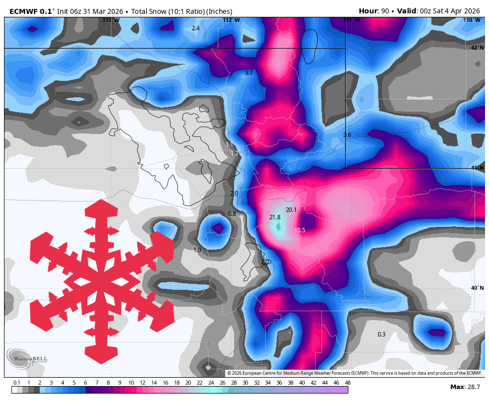
"The first storm arrives Tuesday evening and peaks overnight through Wednesday morning with a warm profile that matters most on the lower mountain. Guidance is converging on the timing of this first push but still diverges on intensity, especially at lower elevations, with the snow level generally bouncing between 7,500 and 9,000 feet before easing toward 7,500-8,000 feet by Wednesday."
"A brief relative lull Wednesday evening is followed by a colder, stronger round from late Wednesday night through Friday morning, and that is the better ski storm. Guidance is fairly well aligned on the colder timing, the sharp drop in snow levels from roughly 7,500-8,500 feet Thursday morning to near 3,000-5,000 feet by Friday."
Utah's weather will be active from Tuesday night through Friday, featuring a warm first wave followed by a colder second push. The best ski conditions are expected late Thursday into Friday, with significant mountain precipitation and fluctuating snow levels. The upper Cottonwoods may receive 20-30 inches of snow, while Park City could see 14-20 inches. After this period, the weather will trend quieter and milder, with only a weak signal for late-period refreshers.
Read at SnowBrains
Unable to calculate read time
Collection
[
|
...
]