"Confidence is highest through Saturday because the individual models agree well on the timing of the Thursday storm and the following break. Southern California's mountains pick up a quick shot of snow on Thursday with strong winds, then dry out into the weekend. Beyond the weekend, the signal stays active, but model spread grows fast on storm timing, snow levels, and wind impacts, so expect meaningful swings from run to run."
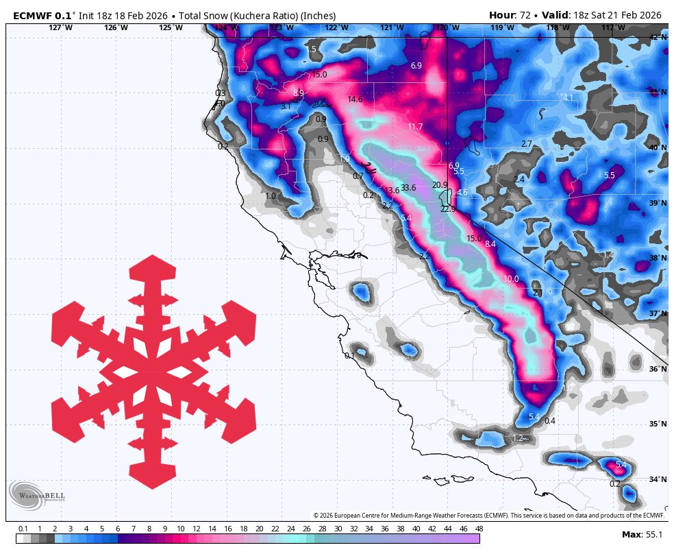
"Wednesday night through Thursday evening brings a cold, windy reload with 5″-29″ of new snow across California's ski areas. Snow ramps up again overnight, with the most intense stretch Thursday morning into early afternoon for the central Sierra and Tahoe resorts, then tapering Thursday night. All models line up well on the overall timing and the cold airmass, while amounts still vary by favored terrain and exact storm track."
"Snow levels stay very low for the Sierra, generally around 1,500 to 2,500 feet and occasionally lower, so this stays all snow at resort elevations. Snow quality looks strong in the Sierra with SLRs commonly 14-18:1 around Tahoe and pushing 16-20:1 near Mammoth for lighter, drier powder. Southern California's mountains run denser with SLRs closer to 7-10:1, and wind becomes a major player with ridgetop gusts in the 45-60 mph range during the heart of the storm."
A cold, windy storm will affect California from Wednesday night into Thursday evening, producing 5″–29″ of new snow across ski areas. Snow will intensify Thursday morning into early afternoon for the central Sierra and Tahoe, then taper Thursday night. Snow levels will remain very low around 1,500–2,500 feet, keeping resort elevations all-snow. Sierra snow ratios will be high (14–18:1 around Tahoe, 16–20:1 near Mammoth) for drier powder. Southern California mountains will have denser snow (7–10:1) with ridgetop gusts of 45–60 mph. Friday and Saturday will be mostly dry with lighter winds, then storm chances return late weekend and next week with growing model uncertainty.
Read at SnowBrains
Unable to calculate read time
Collection
[
|
...
]