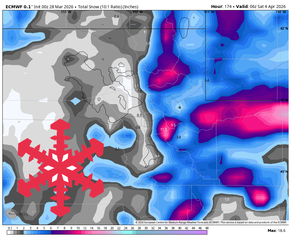
"Expect mostly dry groomer weather this weekend and Monday, then several rounds of snow that begin dense near 8,000 to 9,000 feet before snow levels crash and snow quality improves late Thursday into Friday."
"Saturday through Monday looks mostly dry and very mild for late March, with spring skiing conditions dominating statewide. Resort temperatures run mainly in the 40s and low 50s during the day."
"The pattern shifts late Monday night into Wednesday as the first wave spreads precipitation into the mountains, but it starts warm enough to keep snow quality mediocre at many elevations."
"Snow in this phase looks dense, with SLRs mostly around 4-10:1, and totals are modest outside the upper Wasatch."
Utah will experience mild spring weather through Monday, with temperatures in the 40s and low 50s. From March 31 to April 3, unsettled weather will bring several rounds of snow, particularly in the Cottonwoods. Initial snow quality will be mediocre, but conditions will improve late Thursday into Friday. Confidence in the forecast is high for the early week, with potential for rain or wet snow at lower elevations. After April 3, conditions are expected to become quieter and milder again.
Read at SnowBrains
Unable to calculate read time
Collection
[
|
...
]