"Confidence is highest from Saturday afternoon, May 16 through Sunday afternoon, May 17, when the models converge on low snow levels, gusty westerly winds, and modest additional accumulation. Timberline is scheduled for weather-dependent spring operations, Mt. Bachelor, Crystal Mountain, Snoqualmie Pass, Stevens Pass, and Mt. Baker are closed for winter, and Whistler has limited late-season Blackcomb terrain for intermediate and advanced riders."
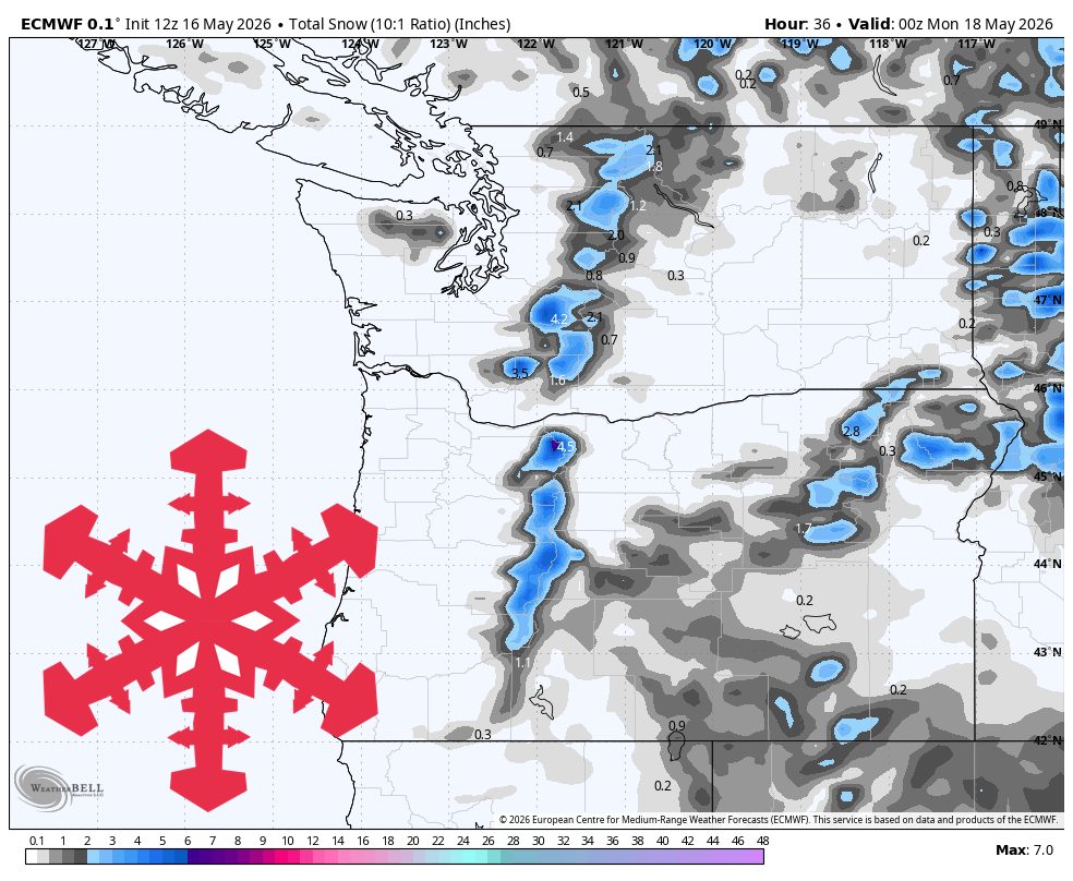
"The ongoing storm continues through Saturday afternoon and night, with the models converging on the strongest snow near Mt. Hood and the central Oregon Cascades. Snow levels sit around 3,500-4,500 feet and may dip in heavier showers, so Timberline and the upper Mt. Bachelor terrain stay cold enough for snow while the lower Washington Cascades see mostly scraps. Snow quality is dense to fair, with SLRs around 8-13 near the Oregon snow belt and poorer, wetter ratios around 5-8 for the lower Washington passes."
"By Sunday, the trough pulls away and the snow showers wind down rather than reload. The models remain well aligned on drying by late Sunday, then mostly dry weather Monday through Thursday as ridging builds offshore and temperatures trend warmer. Isolated mountain showers are possible Monday and Tuesday and again around Thursday, but the signal is weak and inconsistent, with little support for meaningful accumulation."
"Snow levels rise above the pass elevations during any minor showers, so remaining ski weather is more about firm-to-soft spring surfaces, lighter winds, and daytime warming than new snow. Westerly winds remain the main ski-impact issue, with exposed higher terrain likely to feel gusty and uneven."
A cool, showery Saturday storm targets Mt. Hood and the Oregon Cascades, with 5–7 inches possible at Timberline before a mostly dry, warmer stretch begins. The strongest snow occurs Saturday afternoon through Sunday afternoon, when models align on low snow levels, gusty westerly winds, and modest additional accumulation. Snow levels range around 3,500–4,500 feet and may lower in heavier showers, keeping Timberline and upper Mt. Bachelor cold enough for snow while lower Washington Cascades see mostly scraps. Snow quality is dense to fair, with stronger snow-to-liquid ratios near the Oregon snow belt and wetter ratios farther north. Sunday brings drying as showers wind down, followed by mostly dry conditions Monday through Thursday with only weak, inconsistent mountain showers and little accumulation potential.
Read at SnowBrains
Unable to calculate read time
Collection
[
|
...
]