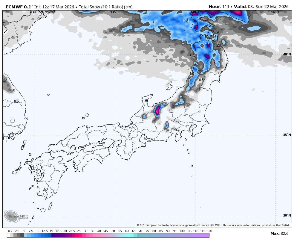
"The Thursday night through Saturday night period is the clear core of this forecast, with favored Hokkaido terrain lining up for 30-50 cm, Appi closer to 13-20 cm, and most central Honshu resorts in only the 0-10 cm range. The models are converging well on the timing of the main burst and agree that snow levels in Hokkaido stay near sea level through the event, so nearly all precipitation falls as snow there."
"Snow quality should improve as the storm matures, starting with denser 6-10 SLR snow and trending to a more comfortable 10-15 range by Friday night and Saturday as colder air settles in. North Honshu looks snowier than points farther south, but it is also the windiest piece of the map, with exposed terrain periodically dealing with 60-100 km/h gusts in the stronger solutions."
"Central Honshu sits on the southern edge of the moisture plume, where precipitation is spottier, snow levels often start around 600-1,500 meters, and only the highest terrain consistently stays cold enough for meaningful accumulation before the moisture pulls away."
A significant winter storm system will impact Japan from Thursday, March 19 through Sunday, March 22, with the strongest snowfall concentrated in Hokkaido. The core forecast period shows Hokkaido accumulating 30-50 cm, Appi receiving 13-20 cm, and central Honshu resorts collecting only 0-10 cm. Snow levels in Hokkaido remain near sea level throughout the event, ensuring nearly all precipitation falls as snow. Snow quality improves as the storm develops, transitioning from denser 6-10 SLR snow to a more comfortable 10-15 range by Friday night and Saturday. North Honshu experiences windier conditions with gusts reaching 60-100 km/h on exposed terrain. Central Honshu sits on the southern edge of the moisture plume with spottier precipitation and higher snow levels starting around 600-1,500 meters. By Sunday, the main storm weakens, with follow-up opportunities of 5-15 cm possible in northern areas through Tuesday.
#japan-ski-weather #hokkaido-snowfall #winter-storm-forecast #snow-accumulation-predictions #regional-weather-patterns
Read at SnowBrains
Unable to calculate read time
Collection
[
|
...
]