"Thursday through Sunday morning stays mostly dry across the region, with the best weather of the forecast for spring laps and corn cycles. Clear nights support freezes into the 20s F and low 30s F at most mountains, then afternoon temperatures rebound into the 30s F and 40s F."
"Snow chances return Sunday afternoon through Monday, and this first round still looks modest. Guidance is converging on the timing of a weak front, but it still diverges on how far south the steadier snow reaches and on how high snow levels briefly climb at the start."
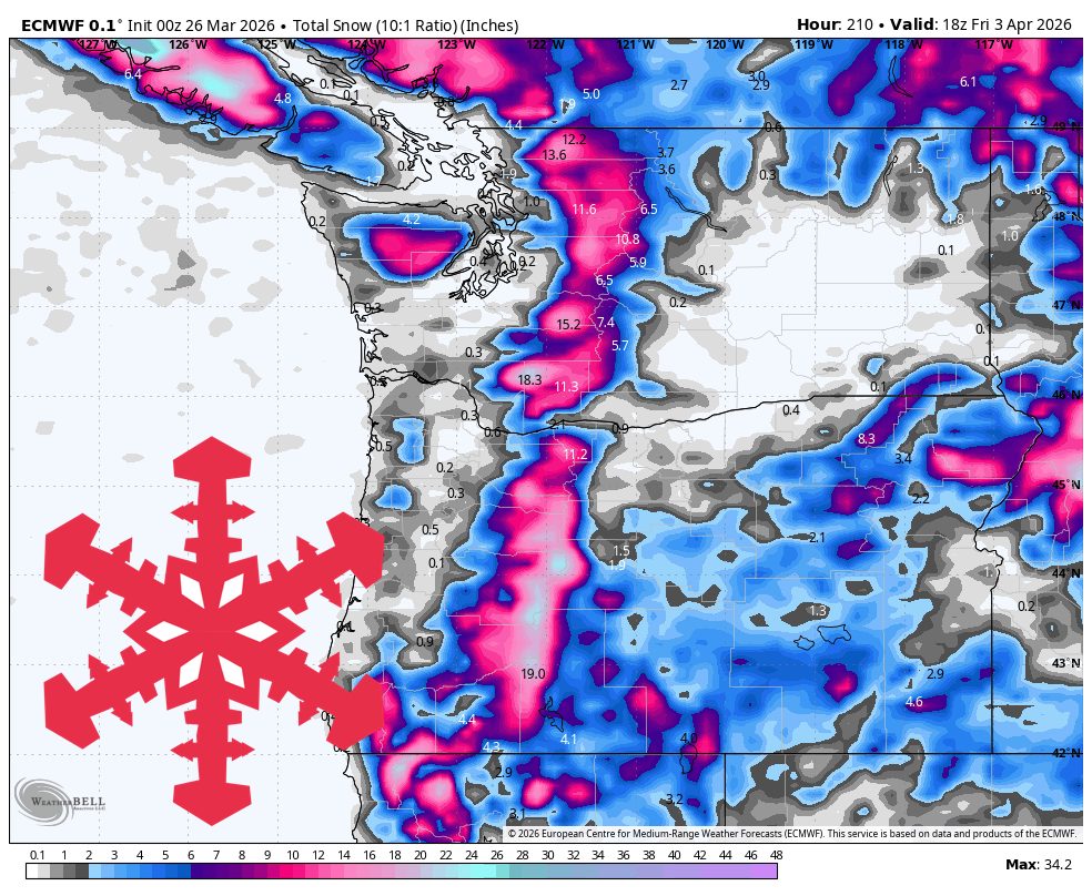
"Expect roughly 1″-3″ for most Washington Cascades resorts, 3″-6″ at Mt Baker, around 2″-3″ at Whistler, and little more than a trace to 1″ farther south."
A quiet spring stretch will last through the weekend in the PNW, with cooler and snowier weather expected from Sunday afternoon to Friday morning. The first round of snow will be light, mainly affecting the Washington Cascades and Whistler. A stronger midweek storm is anticipated to bring significant snowfall to Mt Baker and Timberline. Early snow conditions will be denser at lower elevations, improving as colder air arrives midweek. The period from Thursday to Sunday morning will remain mostly dry, ideal for spring activities.
Read at SnowBrains
Unable to calculate read time
Collection
[
|
...
]