"Areas of rain, sleet and hill snow will move south-eastwards through Monday evening and night before clearing to the North Sea. Whilst some patchy accumulations of snow will be possible, more especially on ground above 150-200m elevation, ice will be a greater hazard as temperatures fall fairly quickly once showers clear away. In addition, a period of strong north-westerly winds are also likely along some North Sea coasts later in the night and into Tuesday morning."
"Overnight Monday into Tuesday we will see a frosty start. It's going to be a largely dry day, some decent amounts of winter sunshine. But it does start to go downhill later in the day, from the south and the west we've got a broad area of cloud and rain pushing in south-west England and South Wales late on Tuesday, during the course of Wednesday this will bring a mix of rain, sleet and hill snow."
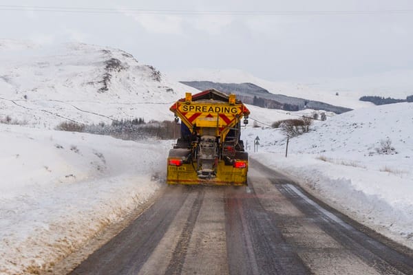
Yellow weather warnings for snow and ice cover multiple UK regions, with drivers and pedestrians advised to exercise caution. Icy conditions may cause slower traffic, travel disruption, and potential accidents. Snowfall is expected on higher ground, especially above 150-200m, while temperatures remain below seasonal averages. Areas of rain, sleet and hill snow will move southeast through Monday evening and night before clearing to the North Sea. Ice will present a greater hazard as temperatures fall quickly once showers clear. Strong north-westerly winds are possible along some North Sea coasts. People are advised to check local forecasts, allow extra journey time, and take precautions against slips and falls.
Read at London Business News | Londonlovesbusiness.com
Unable to calculate read time
Collection
[
|
...
]