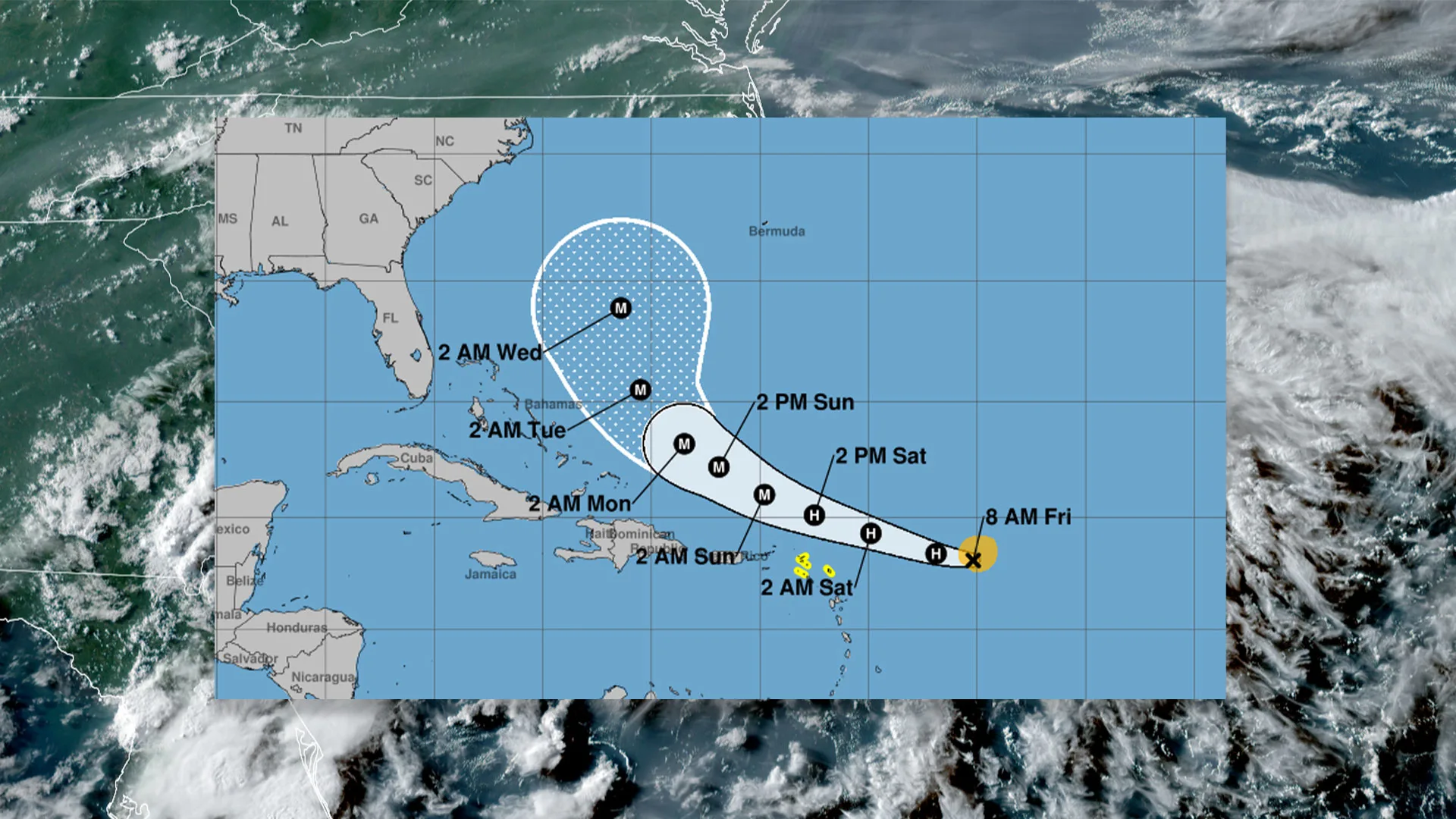
Tropical Storm Erin is currently advancing through the tropical Atlantic, situated east of the Caribbean. It is anticipated to strengthen and likely reach hurricane status soon. The National Hurricane Center reports maximum sustained winds of 70 mph with expectations for further intensification. Heavy rain is projected for the northernmost Leeward Islands and surrounding areas, posing risks of flash flooding and landslides. Despite uncertainty regarding landfall impacts on the Caribbean or U.S. east coast, the storm remains a significant threat even without making landfall.
"Maximum sustained winds are near 70 mph (110 km/h) with higher gusts. Steady strengthening is expected during the next few days and Erin is forecast to become a hurricane later today, and it could become a major hurricane by this weekend."
"Heavy rain is expected across the northernmost Leeward Islands, the U.S. and British Virgin Islands, as well as southern and eastern Puerto Rico. The rains may lead to isolated flash and urban flooding, along with landslides or mudslides this weekend into early next week."
Read at Fast Company
Unable to calculate read time
Collection
[
|
...
]