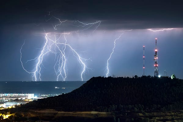
A yellow thunderstorm warning covers 42 areas of the UK for Tuesday between 3pm and 10pm. Temperatures may reach up to 36C after record-breaking May heat and consecutive tropical nights. Warm overnight conditions included a May-night record minimum of 21.3C at Kenley Airfield in south London. Extreme heat combined with unstable air could produce sudden downpours, lightning strikes, and hailstorms. Flooding or lightning could cause delays and cancellations for rail and bus services, while spray and sudden flooding could make driving dangerous and lead to road closures. A small number of homes and businesses could face rapid flooding and damage from floodwater, hail, strong winds, and lightning. There is also a slight possibility of power cuts and disruption to essential services. People outdoors should seek enclosed shelter and avoid trees or elevated ground, and households in flood-prone areas should prepare emergency flood kits and contingency plans.
"The Met Office has issued a yellow thunderstorm warning covering 42 areas of the UK, cautioning that isolated but intense storms could bring disruption between 3 pm and 10 pm on Tuesday. Forecasters predict temperatures could climb as high as 36C, potentially surpassing the record already set for the hottest May day ever recorded in Britain. Large parts of the country endured exceptionally warm overnight conditions on Monday, with temperatures at Kenley Airfield in south London failing to drop below 21.3 °C."
"Forecasters warned that the combination of extreme heat and unstable atmospheric conditions could trigger sudden downpours, lightning strikes and hailstorms in some areas. The Met Office said there was a risk of delays and cancellations to rail and bus services where flooding or lightning strikes occur. Motorists were also warned that spray and sudden flooding could lead to dangerous driving conditions and possible road closures."
"A small number of homes and businesses could face rapid flooding, with potential damage from floodwater, hail, strong winds and lightning strikes. The forecaster also warned of a slight possibility of power cuts and disruption to essential services in affected areas. In guidance issued alongside the alert, the Met Office urged people caught outdoors during thunderstorms to seek enclosed shelter and avoid trees or elevated ground due to the risk of lightning."
"Officials also advised households in flood-prone locations to consider preparing emergency flood kits and contingency plans. The warning comes as forecasters predict temperatures could climb as high as 36C, potentially surpassing the record already set for the hottest May day ever recorded in Britain. The Met Office confirmed it was the warmest May night on record, following another record-breaking overnight minimum the previous evening."
Read at London Business News | Londonlovesbusiness.com
Unable to calculate read time
Collection
[
|
...
]