"Greenland's coastline, much longer than Earth's circumference, poses unique challenges in surveillance as nations eye its rich Arctic resources."
"The Sirius Dog Sled Patrol and sporadic aerial surveys are outdated methods for monitoring Greenland, highlighting the need for an improved and efficient system."
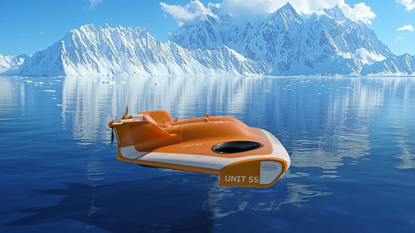
"Introducing the AquaGlider, a solar-powered autonomous drone designed to efficiently survey Greenland's vast, unpredictable landscape, thus addressing current surveillance shortcomings."
"Innovative solutions like the AquaGlider could transform monitoring systems in Greenland, enabling continuous oversight of its important and resource-rich territories."
Greenland's 27,394-mile coastline is logistically challenging to monitor, especially amid rising neocolonial interest from countries like Russia and the U.S. Denmark's current methods, including the Sirius Dog Sled Patrol and sporadic aerial surveys, are slow and ineffective, exposing significant surveillance gaps, exemplified by a year-long oversight of a tsunami in Dickson Fjord. To improve this monitoring, Jens Martin Skibsted and his team at Manyone are developing the AquaGlider, a solar-powered autonomous drone capable of efficiently surveying Greenland's vast landscape, thus addressing current surveillance deficiencies while ensuring security over valuable resources in the Arctic.
Read at Fast Company
Unable to calculate read time
Collection
[
|
...
]