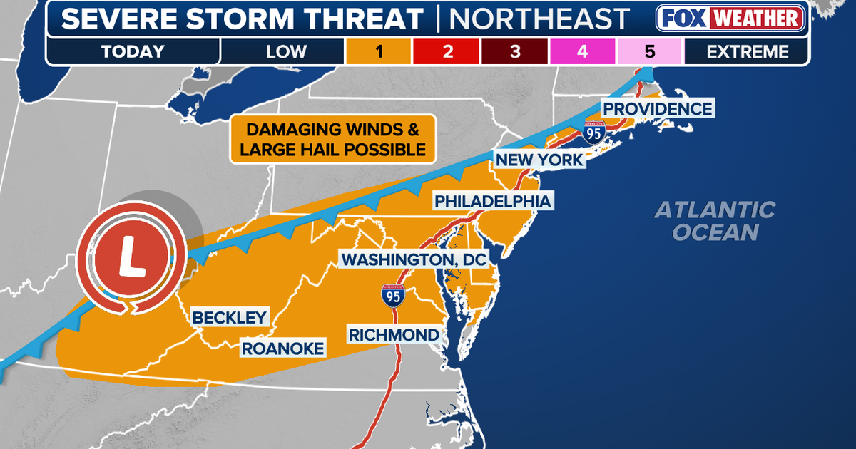
A cold front is expected to reach the Northeast by Wednesday, bringing clusters of thunderstorms along the Interstate 95 corridor from Boston to Richmond, Virginia. The National Weather Service issued a Severe Thunderstorm Watch for much of the region, including New Jersey, New York City, Long Island, and parts of New York and southern Connecticut. The watch runs from 2 p.m. to 9 p.m. Tuesday. Concerns include hail up to quarter size, wind gusts up to 70 mph, frequent lightning, and heavy rain. Heavy rain may cause wet roads, reduced visibility, and slower travel during commute times. Heat ahead of the front is helping fuel storm development, while cooler air behind the front will drop temperatures into the 60s across the corridor and keep them cooler into Memorial Day weekend.
"FOX Weather reported that a cold front is expected to reach the Northeast by Wednesday, bringing clusters of thunderstorms capable of strong wind gusts and large hail across the Interstate 95 corridor from Boston to Richmond, Virginia."
"The National Weather Service issued a Severe Thunderstorm Watch for much of the region on Wednesday, including all of New Jersey, New York City and Long Island, as well as Orange, Westchester, Rockland and Putnam counties in New York, and southern Connecticut. The watch is in effect from 2 p.m. to 9 p.m. Tuesday."
"According to the NWS, the biggest concerns are hail that could reach the size of a quarter, wind gusts that could hit 70 mph and frequent lightning. Heavy rain could also lead to wet roads, reduced visibility and slower travel, especially if storms move through during commute times."
"FOX Weather reported that heat ahead of the front is helping fuel storm development. Much of the Southeast, Mid-Atlantic and Northeast has been dealing with temperatures in the 90s, according to FOX Weather. As the cold front moves east, that heat could help produce thunderstorms along the front."
Read at FOX 5 New York
Unable to calculate read time
Collection
[
|
...
]