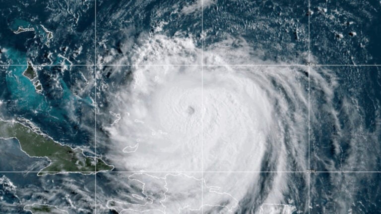
"Hurricane Erin reintensified to a Category 4 storm with maximum sustained winds of 130 mph, impacting the Caribbean and threatening the U.S. East Coast with dangerous surf."
"The hurricane was about 105 miles north-northeast of Grand Turk Island, moving northwest at 13 mph, while coastal areas prepared for significant impacts and potential evacuations."
Hurricane Erin reintensified to a Category 4 storm with maximum sustained winds of 130 mph. It moved closer to the Southeast Bahamas and was about 105 miles north-northeast of Grand Turk Island. The storm was moving northwest at 13 mph. A Tropical Storm Watch was issued for central Bahamas, while a Tropical Storm Warning remained for Turks and Caicos Islands. Hurricane-force winds extended 60 miles from the center, and tropical-storm-force winds extended 230 miles outward. Erin is expected to impact coastal areas despite not making landfall.
Read at Boston.com
Unable to calculate read time
Collection
[
|
...
]