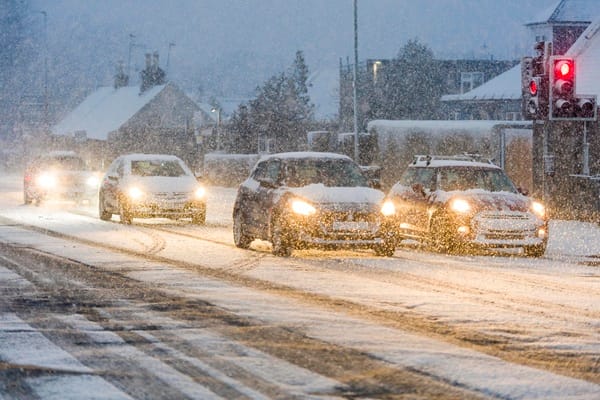
"Storm Goretti has been an impactful weather system, with significant disruption and impacts reported so far. A peak gust of 99mph was reported at St Marys on the Isles of Scilly, the highest here since 1991. Accumulations of snow have also been reported, 15cm has been recorded at Lake Vyrnwy in Powys, 7cm at Preston Montford in Shropshire and 7cm at Nottingham. Wider accumulations have been recorded, as well as some higher unofficial totals from non-Met Office observations."
"Notable snow accumulations continue in Scotland, with 27cm at Altnaharra in Sutherland, 26cm at Loch Glascarnoch and 22cm at Durris in Kincardineshire. The lowest temperature recorded overnight was -13.3°C at Braemar, Aberdeenshire. The influence of Storm Goretti will reduce through Friday, though the system will be responsible for the further wet weather in eastern parts of England through the day as the system gradually moves towards mainland Europe."
Storm Goretti produced very strong winds and widespread wintry conditions across parts of the UK, including a peak gust of 99mph at St Marys on the Isles of Scilly and subzero temperatures. Significant snow accumulations have been recorded in Wales, England and Scotland, with local totals such as 15cm at Lake Vyrnwy, 27cm at Altnaharra and a low of -13.3°C at Braemar. The storm's influence will reduce through Friday, bringing wet weather in eastern England. Conditions will improve on Saturday with some sunny spells, but ice, wintry showers and further snow on high ground are likely. A new front on Sunday risks disruptive snow for northern areas.
Read at London Business News | Londonlovesbusiness.com
Unable to calculate read time
Collection
[
|
...
]