Utah ski resorts will experience warm, mostly dry conditions through Saturday with temperatures in the upper 20s to lower 40s and elevated snow levels around 8,000 to 10,500 feet. A more reliable snow period arrives Sunday night through Tuesday, with snow levels near 6,000 to 9,500 feet and accumulation expected across open resorts, particularly in upper Cottonwoods. Snow quality will be dense to moderate with snow-to-liquid ratios of 4:1 to 12:1. Wind impacts remain moderate with sustained ridge winds of 10-20 mph. Beyond Wednesday night, forecasting confidence decreases significantly, with guidance suggesting a potentially more active period and cooler snow levels, though snowfall outcomes remain highly uncertain.
"Thursday night through Saturday trends warm and mostly quiet, and guidance is converging on that timing and lower-impact intensity. Expect only spotty lingering snow showers early, then long dry breaks with mountain temperatures generally in the upper 20s to lower 40s and snow levels often around 8,000 to 10,500 feet."
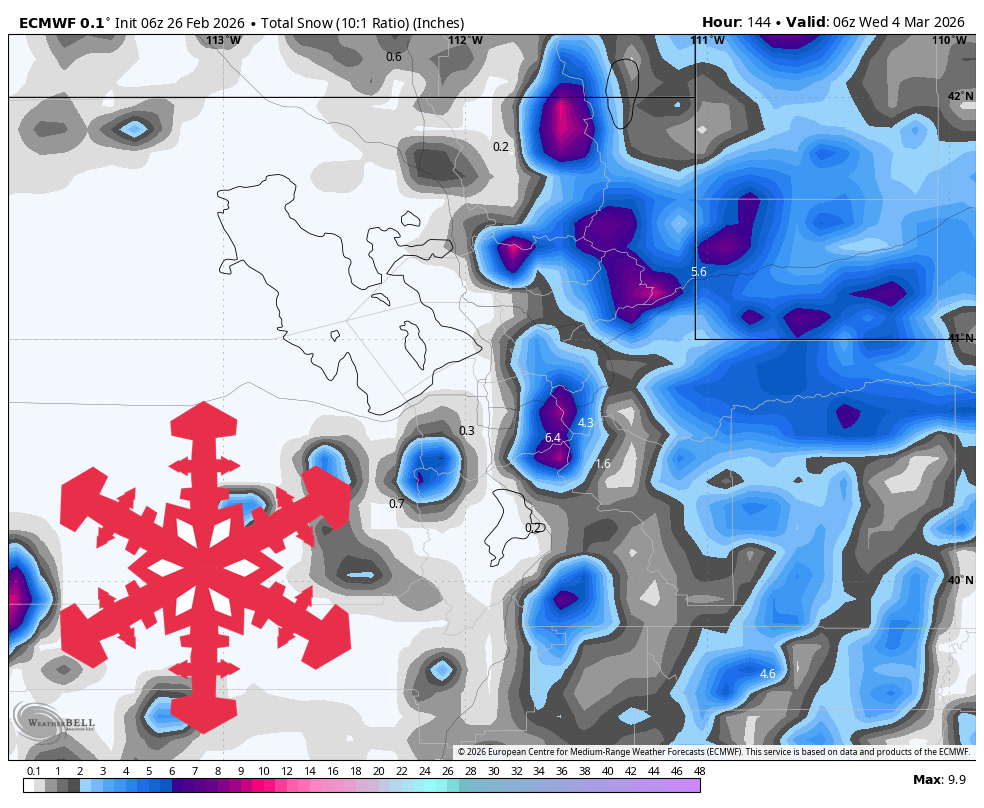
"Sunday night through Tuesday is the best-defined snow period, with guidance converging on precipitation timing but diverging on intensity from one solution cluster to another. Snow levels generally hold high, near 6,000 to 9,500 feet, so lower elevations can mix with rain while upper mountains stack mostly snow."
"For this confidence window, snowfall is generally in the range, with the best odds for higher totals in the upper Cottonwoods and lighter amounts farther south and east. SLRs during the core of this wave are mostly 4:1 to 12:1, so snow quality ranges from dense to moderate rather than blower powder."
#utah-skiing-forecast #spring-snow-conditions #mountain-weather-patterns #snow-quality-and-accumulation
Read at SnowBrains
Unable to calculate read time
Collection
[
|
...
]