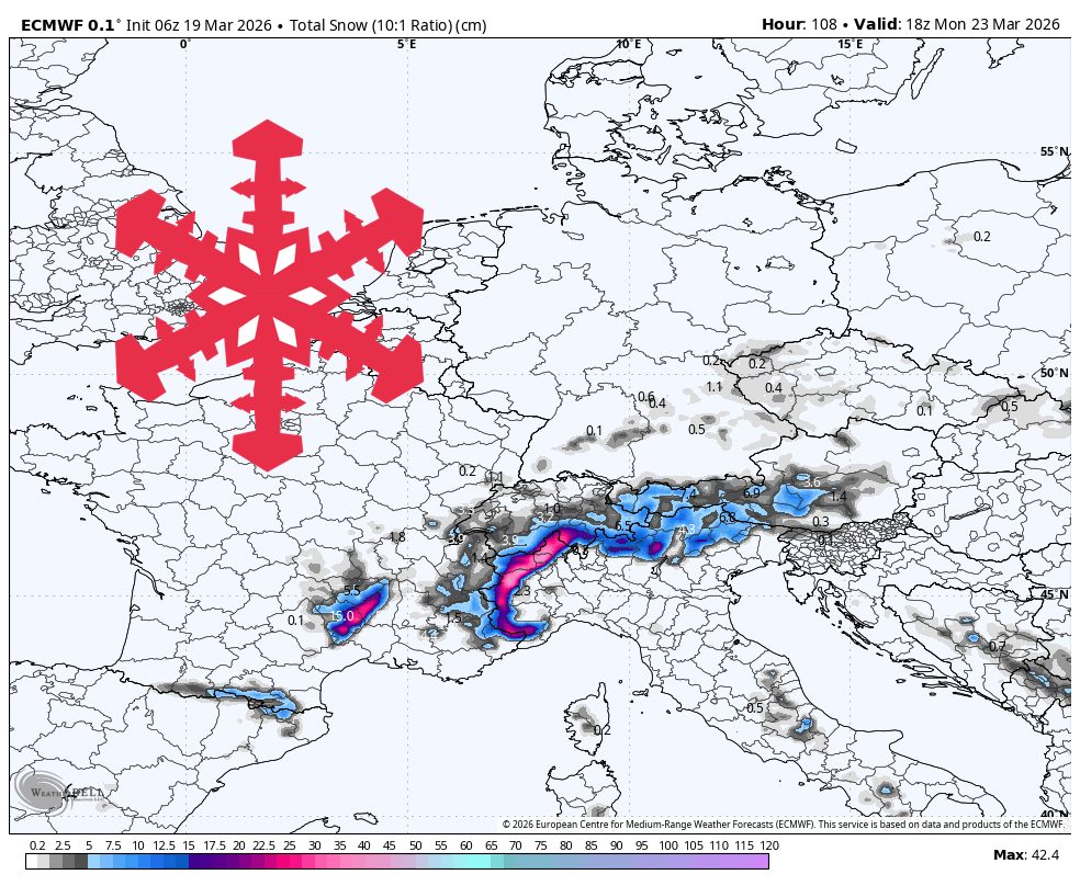
The European Alps face a dry period from Thursday through Saturday afternoon, ideal for skiing with temperatures ranging from -7 to 1°C and light winds under 10 km/h. Late Saturday into Sunday brings modest snow refresh with 5-15 cm expected at higher elevations, snow levels around 900-1,400 meters, and minimal wind impact. Confidence remains high through Monday evening as weather models converge on this timing. After Tuesday, the pattern becomes more active and unsettled with a colder late-week storm system developing, though its exact placement and intensity require further clarification.
"Guidance is tightly converged from Thursday through Saturday afternoon on a mostly dry stretch, so skiing weather should be fairly straightforward to start the period. Temperatures at forecast elevations generally stay near -7 to 1 C, which should keep high terrain in decent shape after cold mornings while afternoons trend more springlike on sun-exposed slopes."
"The weekend wave still looks like a modest refresh rather than a major storm, with many higher resorts favored for 5-15 cm from late Saturday through Monday evening. Confidence is highest in that time range because the individual models are converging on the broader timing, with the first burst arriving Saturday night into early Sunday for the central and eastern Alps."
"After Tuesday, the pattern turns more active but much less settled, with a colder late-week storm signal that still needs more time to sort out placement and scale."
#alpine-weather-forecast #snow-accumulation #skiing-conditions #weather-pattern-analysis #storm-system-development
Read at SnowBrains
Unable to calculate read time
Collection
[
|
...
]