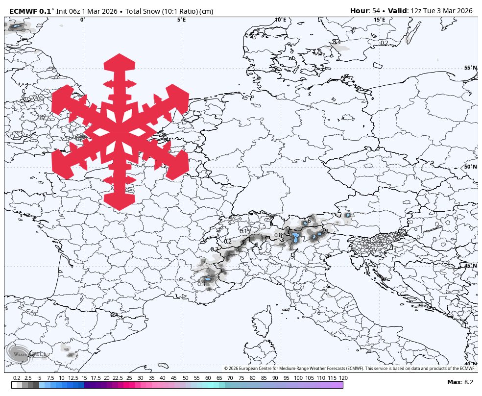
"From Sunday afternoon through early Tuesday, guidance converges on timing but diverges on intensity, so confidence is highest in a light event rather than a strong storm. Snow should be most persistent Sunday evening into Monday night, then taper Tuesday morning. The conservative near-term expectation is light accumulation for many resorts, with localized higher-terrain totals near 7 cm in the western and southern Alps."
"Snow levels during this wave are generally around 1,300 meters to 1,900 meters, occasionally near 2,000 meters, so upper-mountain terrain stays wintry while lower elevations can trend wetter at times. Temperatures during snowfall are mostly about -6 C to 2 C. SLRs cluster around 8-13, which supports mostly dense to fair snow, with occasional 6-8 periods that can feel heavier."
"From Tuesday afternoon through Friday, guidance is well converged on a quieter stretch with only spotty, low-end snow showers. Most mountains should see long dry breaks, so ski conditions will be driven more by overnight refreezes and daytime temperature swings than by new snow. Typical temperatures run from about -8 C to 4 C, and winds stay mostly modest outside exposed ridges."
A weak weather system will bring modest snow accumulation to the European Alps from Sunday through early Tuesday, with most resorts receiving only a few centimeters and higher terrain reaching approximately 7 cm. Snow quality will be mostly dense to fair with manageable winds. Snow levels range from 1,300 to 2,000 meters, keeping upper terrain wintry while lower elevations experience wetter conditions. Temperatures during snowfall range from -6°C to 2°C with snow-to-liquid ratios of 8-13. Following Tuesday, conditions turn quieter through Friday with only spotty showers and long dry breaks. Ski conditions will depend on overnight refreezes and temperature fluctuations rather than new snow. Confidence decreases significantly for conditions beyond Friday.
Read at SnowBrains
Unable to calculate read time
Collection
[
|
...
]