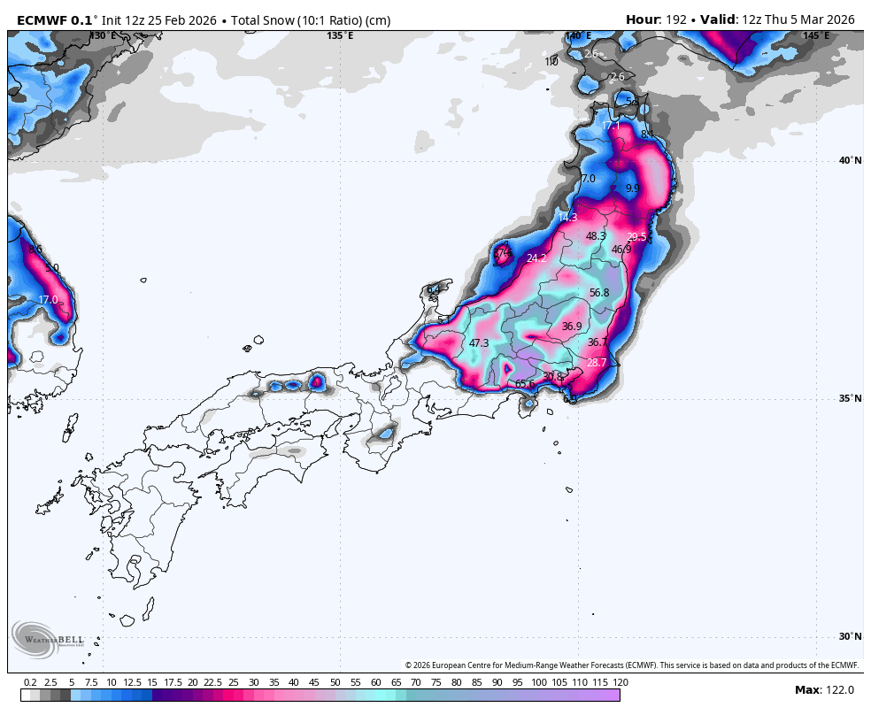
Japan is entering a snowy stretch with the most reliable near-term snow expected in Hokkaido from Saturday through Monday, with storm totals ranging from 20 to 60 centimeters in favored zones. Central and northern Honshu will see lighter accumulation of 0 to 10 centimeters during this period. Snow levels remain low, generally near sea level to 700 meters, supporting good snow quality across mid and upper mountain terrain. From Tuesday through Thursday, broader snowfall is expected across Honshu with 10 to 40 centimeters likely, though forecast confidence decreases regarding exact placement and intensity. Snow levels trend lower in the second wave, enhancing top-to-bottom snow chances. Colder air maintains fair to good snow quality overall, with snow-to-liquid ratios between 10:1 and 14:1, though denser bursts near 7:1 to 10:1 occur periodically. Winds periodically reach 20 to 35 kilometers per hour with stronger gusts affecting exposed terrain.
"From Saturday through Monday, guidance is converging on a Hokkaido-focused wave with the best overlap in timing, while snowfall intensity still varies from run to run. The practical ski takeaway is that Hokkaido has the strongest near-term signal for consistent refreshes, with storm-cycle totals in the 20 cm to 60 cm class and locally higher pockets in favored zones."
"Snow levels mostly sit low enough for snow at mid and upper mountain terrain, generally near sea level to around 700 meters, with occasional pushes toward 1,000 meters. Temperatures stay cold enough for winter surfaces overall, and SLRs are mostly around 10:1 to 14:1 for moderate to fairly good quality, with intermittent denser bursts near 7:1 to 10:1."
"From Tuesday into Thursday, guidance agrees that broader snowfall returns but diverges notably on where the heaviest bands set up and how long they hold, so confidence in exact resort outcomes is lower. The more likely scenario is a wider Honshu reload with many areas seeing roughly 10 cm to 40 cm, while upside cases are higher where persistent banding develops."
#japan-snow-forecast #hokkaido-skiing #honshu-snowfall #winter-weather-patterns #snow-quality-and-accumulation
Read at SnowBrains
Unable to calculate read time
Collection
[
|
...
]