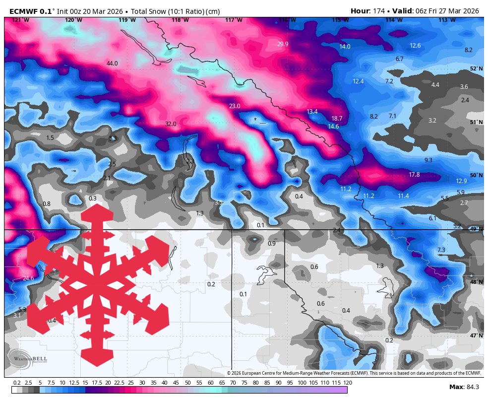
Two short-range storm waves are expected to deliver fresh snow to the Alberta Rockies and Kicking Horse through Thursday. The southern British Columbia interior will experience lighter snowfall. The first wave will be most productive for Lake Louise and Banff Sunshine, with expected accumulations of 15 cm-20 cm by late Saturday. A broader storm is anticipated from Tuesday through Thursday, bringing moderate accumulations across open hills. Snow quality will improve as snow-to-liquid ratios rise, with gusty winds expected in exposed areas during the storm period.
"The first wave is underway Friday and stays most productive through Saturday for the Alberta Rockies, with guidance tightly clustered on onset timing but looser on how far west the better snowfall bands reach."
"Lake Louise and Banff Sunshine look set for roughly 15 cm-20 cm by late Saturday, and Kicking Horse plus Revelstoke are in the 10 cm-15 cm class if the current consensus holds."
"Confidence is highest from Tuesday, March 24 through Thursday, March 26, when every model brings a broader storm back into the region."
Read at SnowBrains
Unable to calculate read time
Collection
[
|
...
]