"and it stays cold enough for all snow the whole way. Snow quality looks strong overall, with SLRs generally running 15-19:1, though a few windows Monday night trend a bit denser in the 12-14:1 range as winds swing around and mixing increases. Expect the windiest stretch during and just after the changeover from easterly flow to gusty northwest flow, when exposed lifts and ridgelines will feel it most."
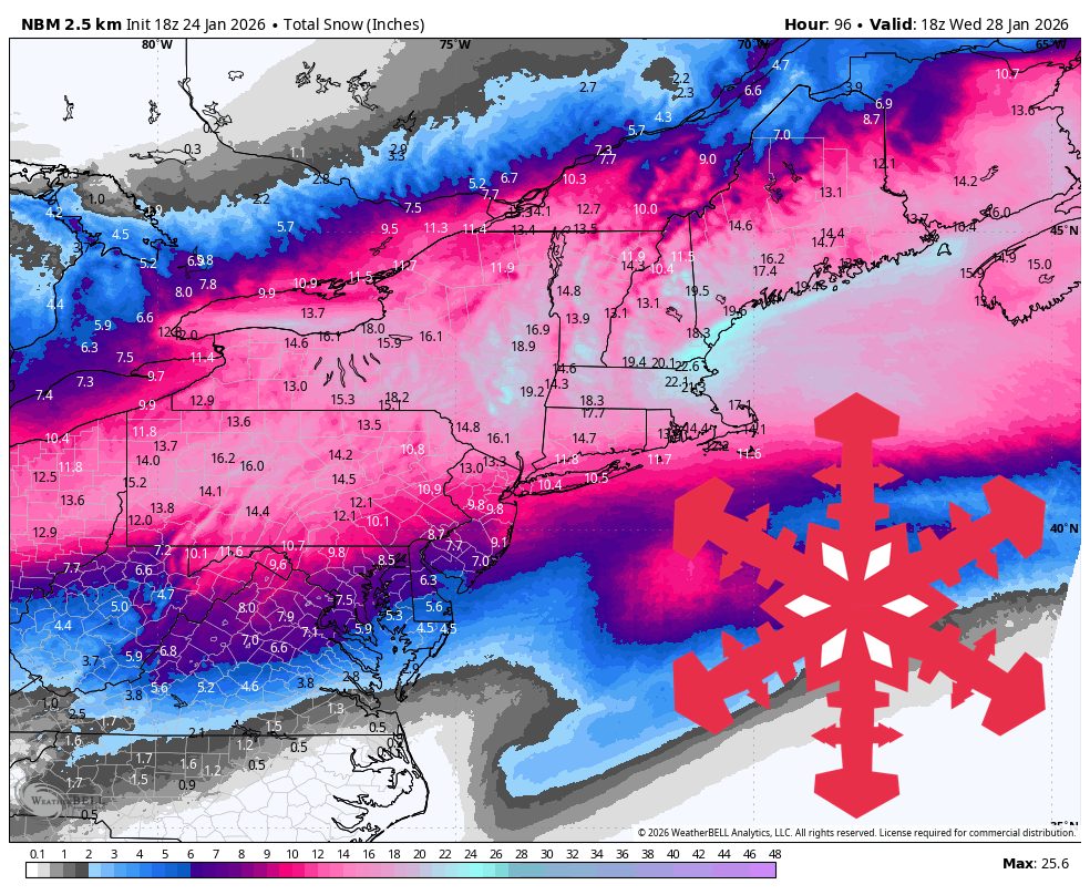
"Sunday night into Monday is the main event, with widespread steady snowfall and occasional heavier bursts that favor the Greens, the Whites, and the western Maine mountains. Totals in the heart of the storm cluster around 9″-15″, led by Stowe at 11″-15″ and Wildcat at 10″-14″, with Loon, Cannon, and Bretton Woods all in the 9″-13″ range. Sunday River and Killington check in a touch lower at 9″-12″, while Sugarloaf lands at 7″-10″. Temperatures stay firmly wintry,"
A powerful storm impacts northern Vermont, New Hampshire's White Mountains, and western Maine from Sunday night into Monday, producing widespread steady snowfall and occasional heavier bursts. Mountains in the core zone generally accumulate 9–15 inches, with Stowe 11–15 inches, Wildcat 10–14 inches, Loon, Cannon, and Bretton Woods 9–13 inches, Sunday River and Killington 9–12 inches, and Sugarloaf 7–10 inches. Temperatures remain cold enough for all snow. Snow-to-liquid ratios mostly sit 14–19:1, with brief 12–14:1 intervals Monday night as winds and mixing increase. Northwest gusts rise late Monday and lingering light snow and upslope refreshers continue into midweek, especially at Stowe.
Read at SnowBrains
Unable to calculate read time
Collection
[
|
...
]