A cold storm is expected in the Australian Alps, delivering 10-25 cm of snow from Wednesday afternoon to Friday morning. Most resorts are closed, making this more of a snowfall update. Snow levels will be around 900-1,300 meters, with dense to moderate snow quality. Winds will be sustained at 30-60 km/h, with gusts reaching 80-120 km/h. Following the storm, a dry and milder pattern will emerge, with temperatures rising to 0 C to 16 C by the weekend, and little additional snowfall expected.
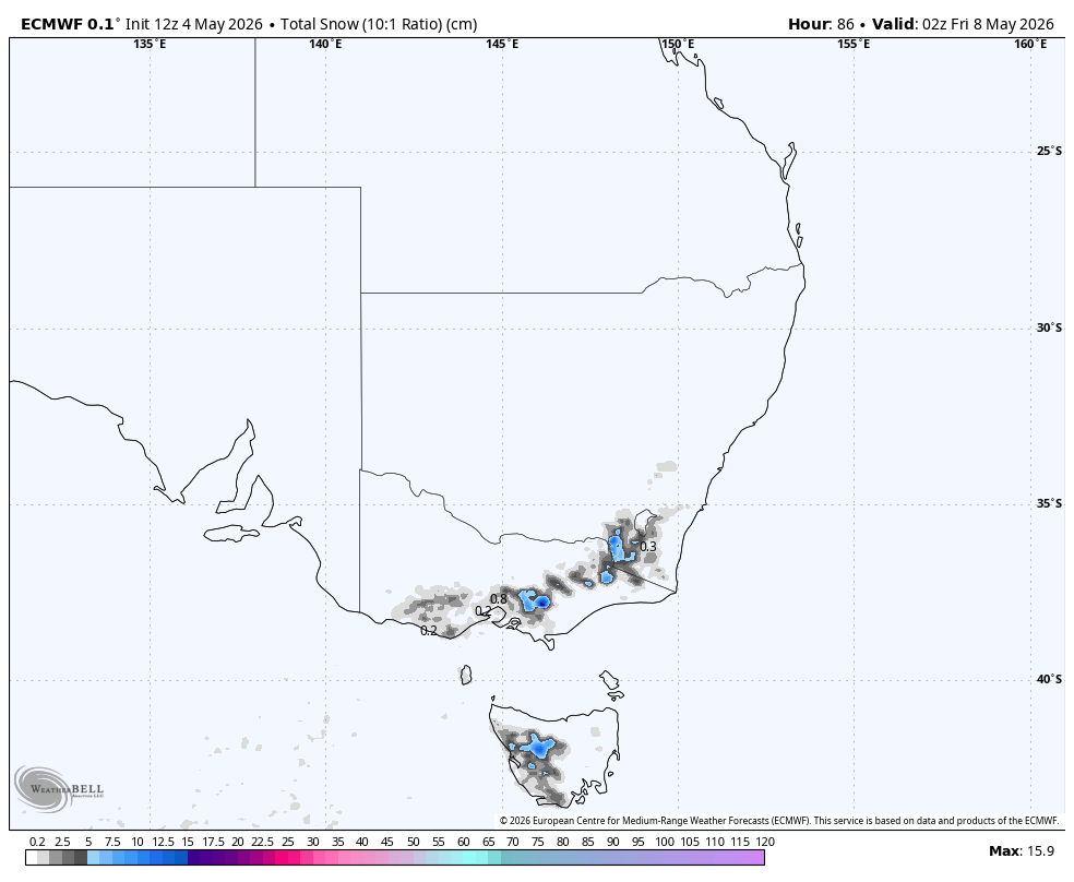
"The strongest signal is for 10-25 cm across many mainland alpine areas, locally higher at Mount Baw Baw, while Tasmania looks lighter and Ben Lomond has little to no snow signal."
"Snow levels while it is snowing are generally near 900-1,300 meters, with colder pockets lower during the main burst, so most alpine elevations should be cold enough for accumulating snow."
"The individual models also agree on a windy storm, though they vary on peak gust strength. Sustained winds commonly run 30-60 km/h during the storm, and exposed terrain could see gusts in the 80-120 km/h range."
"From Friday afternoon through Sunday, the guidance converges on a quick shutoff and a dry, milder pattern. Any leftover snowfall looks negligible, with temperatures recovering to roughly 0 C to 16 C across the terrain by the weekend."
Read at SnowBrains
Unable to calculate read time
Collection
[
|
...
]