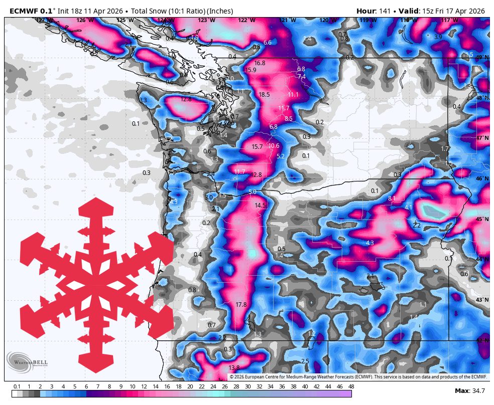
The Pacific Northwest faces unsettled weather with a significant storm expected from Tuesday night through Thursday. Oregon will see denser snow, particularly at Mt. Bachelor and Timberline, as snow levels drop. The storm will provide broader coverage across the Cascade range, with the heaviest snowfall anticipated at Timberline, Mt. Baker, Mt. Bachelor, and Stevens. Snow levels will range from 4,500-7,000 feet in Oregon and 3,000-4,000 feet in Washington, leading to varying snowfall intensities. Gusty winds may affect exposed terrain, but overall conditions are manageable for skiing.
"Oregon starts with denser snow and the best near-term accumulation at Mt. Bachelor and Timberline, then the whole Cascade chain turns colder as snow levels fall toward and below pass level during the midweek system."
"The main forecast period is Tuesday night through Thursday night, when the models converge on a colder and much broader Cascade storm with the best regionwide coverage of the cycle."
"Confidence is strongest from Saturday night through Friday morning because both the ongoing southern-Cascades carryover event and the upcoming storm are expected to deliver significant snowfall."
Read at SnowBrains
Unable to calculate read time
Collection
[
|
...
]