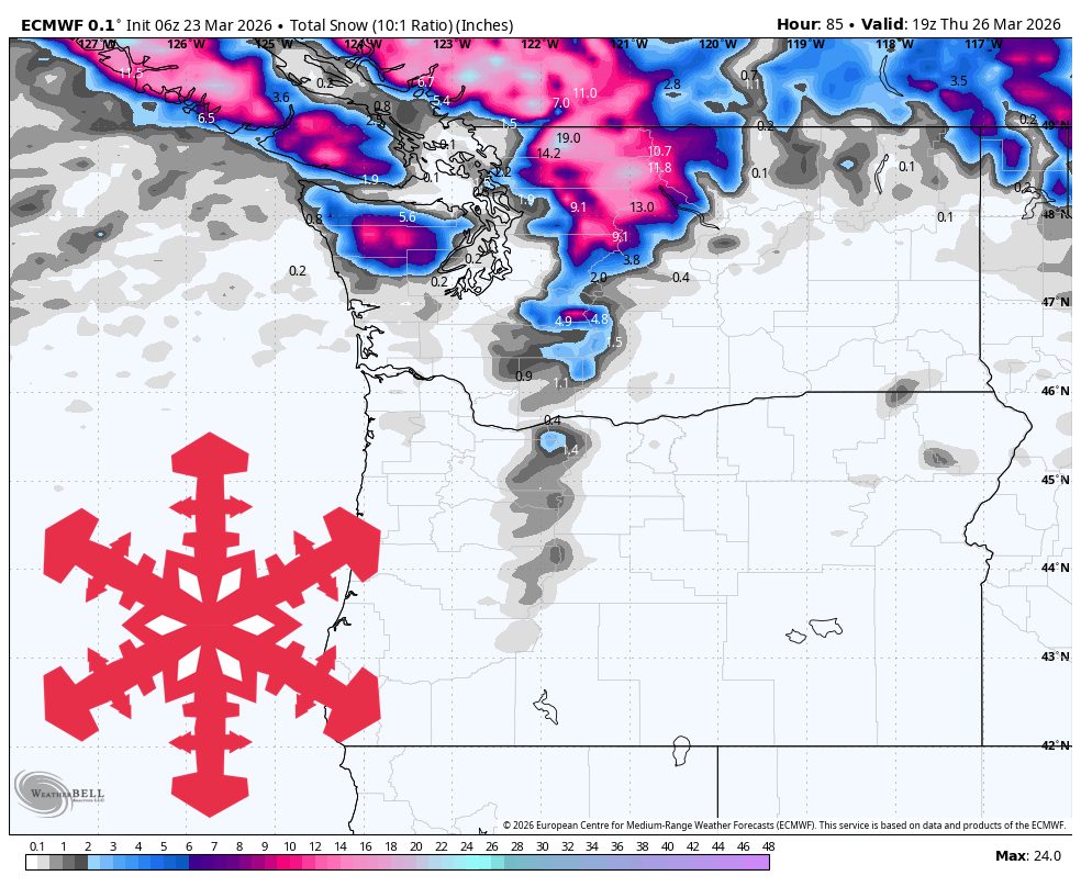
"The most reliable part of this forecast is Tuesday morning through Thursday midday, when a windy Pacific front followed by cooler showers brings the PNW its main midweek refresh."
"Snow starts dense Tuesday with SLRs mostly 5-9 where it is snowing, then improves into the 10-14 range on Wednesday as colder air settles in."
"By Wednesday and Wednesday night, the guidance remains well clustered on colder air dropping snow levels toward 1,000-2,500 feet and improving snow quality."
"Thursday through Saturday looks much simpler, and guidance is strongly convergent on drying, lighter wind, and a steady warming trend."
A windy Pacific front will bring snowfall to the Pacific Northwest from Tuesday morning through Thursday midday. Whistler and Mt Baker are expected to receive the most snow, while Oregon remains warmer. Snow will start dense on Tuesday, improving in quality by Wednesday as colder air settles in. Snow levels will drop to 1,000-2,500 feet by Wednesday night. After this period, conditions will dry out with a warming trend, leading to spring-like weather by Thursday.
Read at SnowBrains
Unable to calculate read time
Collection
[
|
...
]