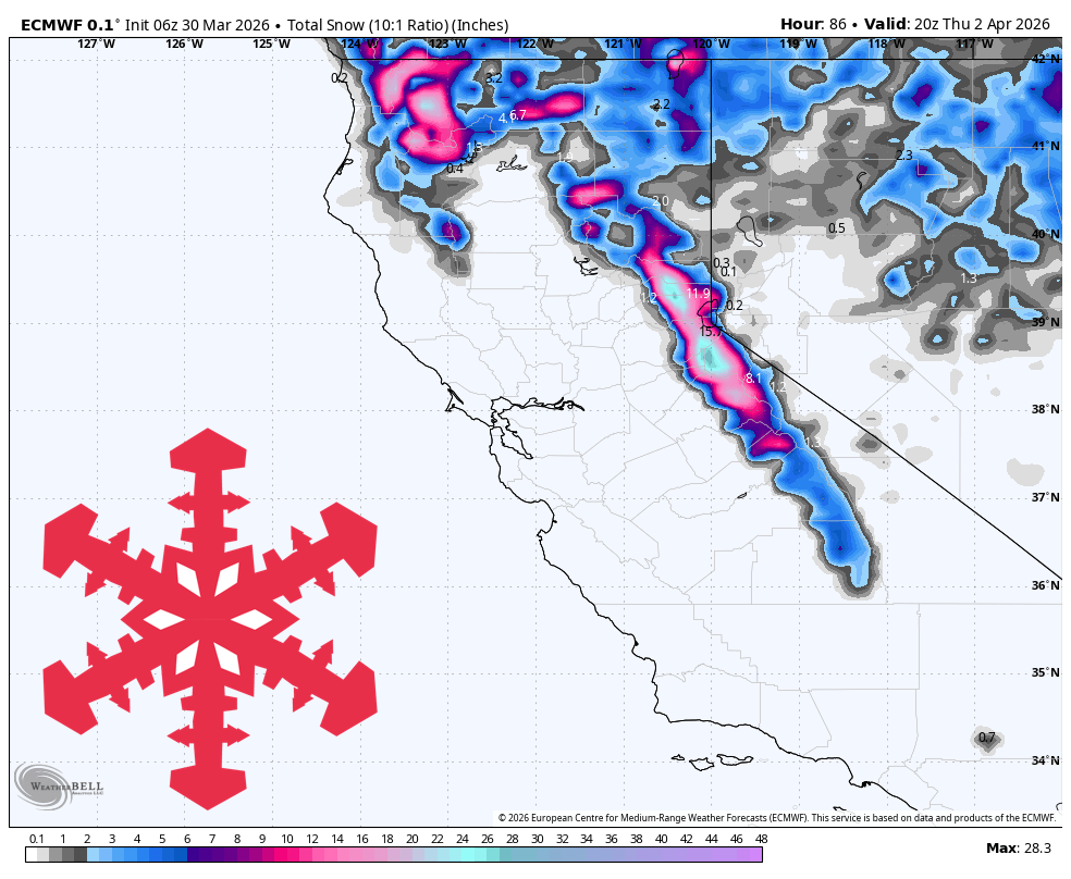
"The storm is expected to bring generally 3"-19" of snow to open Sierra and Carson Range resorts, with the best totals on the Tahoe crest and Mammoth receiving 7"-10"."
"Snow quality will start dense on Tuesday with SLRs mostly 7-10, improving into the 10-13 range late Wednesday night and Thursday as snow levels fall."
"A colder wave will push through Wednesday into Thursday, maintaining snowfall while dropping snow levels toward 4,500 to 6,000 feet by the end of the storm."
"Expect the best overall refresh on the Tahoe crest with broadly 11"-19", while wind gusts will frequently reach 45 to 70 mph on Sierra ridges."
From Tuesday morning to Thursday afternoon, a windy storm will deliver 3"-19" of snow across California's Sierra and Carson Range resorts. The heaviest snowfall will occur on the Tahoe crest and Mammoth, with snow quality improving from dense to lighter as temperatures drop. Wind gusts will reach 35-70 mph, impacting conditions. While Bear Valley and Dodge Ridge are closed, open resorts will benefit from the storm, particularly in the Tahoe and Mammoth areas, with snow levels dropping significantly by Thursday.
Read at SnowBrains
Unable to calculate read time
Collection
[
|
...
]